Niedereschach geodata
Niedereschach (Baden-Württemberg) is a seat of a fourth-order administrative division; located in Germany in Europe/Berlin (GMT+2) time zone. With population of 6,004 people, there are 2461 cities with bigger population in this country. Compared to other cities in Germany, 93.6% of cities are located further ↑North; 70.8% of cities are located further →East and 96.9% of cities have lower elevation than Niedereschach. Note1
Administrative division(s):
- Level 1: Baden-Württemberg
- Level 2: Freiburg Region
- Level 3: Schwarzwald-Baar-Kreis
- Level 4: Niedereschach


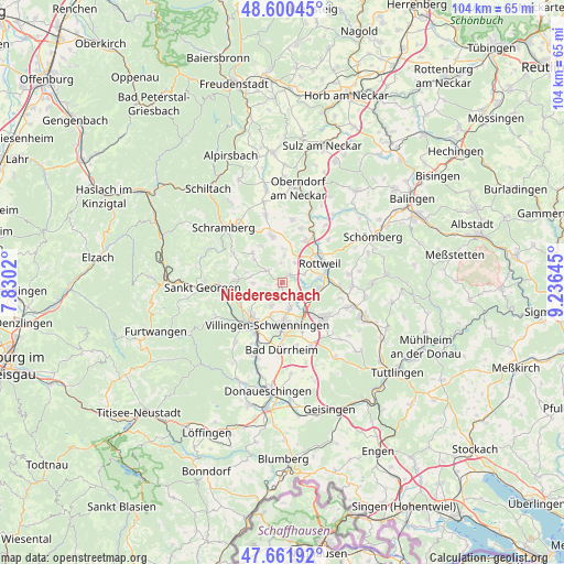
Niedereschach GPS coordinates[2]
48° 7' 59.988" North, 8° 31' 59.988" East
| Map corner | latitude | longitude |
|---|---|---|
| Upper-left | 48.60045°, | 7.8302° |
| Center: | 48.13333°, | 8.53333° |
| Lower-right: | 47.66192°, | 9.23645° |
| Map W x H: | 104.4×104.4 km | = 64.9×64.9mi |
| max Lat: | 55.01917° ⇑93.6% North |
| Niedereschach: | 48.13333° |
| min Lat: | ⇓6.4% South 47.40724° |
| min Long | Niedereschach | max Long |
| 5.92978° | 8.53333° | 14.98853° |
| W 29.2%⇐ | ⇒70.8% E |
Elevation
Elevation of Niedereschach is 659 m = 2162 ft, and this is 409.9 m = 1345 ft above average elevation for this country.
| Max E: |
1256 m = 4121 ft | 3.1% |
| Niedereschach | 659 m 2162 ft | |
| Avg. | 249.1 m = 817 ft | |
Min E: |
-5 m = -16 ft | 96.9% |
See also: Germany elevation on elevation.city.
Geographical zone
Niedereschach is located in North temperate zone (between Tropic of Cancer and the Arctic Circle). Distance of this North polar circle is 2049.2 km =1273.3 mi to North.| Distance of | km | miles | from Niedereschach |
|---|---|---|---|
| North Pole | 4655.1 | 2892.5 | to North |
| Arctic Circle | 2049.2 | 1273.3 | to North |
| Tropic Cancer | 2746 | 1706.3 | to South |
| Equator | 5351.9 | 3325.5 | to South |


Nearby cities:
15 places around Niedereschach: (largest is in red/bold)
• Bad Dürrheim
12.5 km =7.8 mi,  180°
180°
• Bösingen
11.2 km =7 mi,  6°
6°
• Dauchingen
5 km =3.1 mi,  165°
165°
• Deißlingen
6 km =3.7 mi,  113°
113°
• Dietingen
11.7 km =7.3 mi,  47°
47°
• Dunningen
9 km =5.6 mi,  347°
347°
• Hardt
10.3 km =6.4 mi,  302°
302°
• Königsfeld im Schwarzwald
8.4 km =5.2 mi,  273°
273°
• Mönchweiler
9 km =5.6 mi,  246°
246°
• Rottweil
7.9 km =4.9 mi,  61°
61°
• Trossingen
10.4 km =6.5 mi,  127°
127°
• Tuningen
12.2 km =7.6 mi,  155°
155°
• Villingen-Schwenningen
8.4 km =5.2 mi,  200°
200°
• Villingendorf
8.3 km =5.2 mi,  26°
26°
• Zimmern ob Rottweil
5.8 km =3.6 mi, 50°
Sources, notices
• [Note1] Compared only with cities in Germany existing in our database
• [Src1] Map data: © OpenStreetMap contributors (CC-BY-SA)
• [Src2] Other city data from geonames.org with taken over terms of usage.
• [Src3] Geographical zone / Annual Mean Temperature by Robert A. Rohde @ Wikipedia
