Roggentin geodata
Roggentin (Mecklenburg-Vorpommern) is a populated place; located in Germany in Europe/Berlin (GMT+2) time zone. With population of 2,348 people, there are 4604 cities with bigger population in this country. Compared to other cities in Germany, 93.5% of cities are located further ↓South; 84.7% of cities are located further ←West and 85.8% of cities have higher elevation than Roggentin. Note1
Administrative division(s):
- Level 1: Mecklenburg-Vorpommern
- Level 3: Landkreis Rostock
- Level 4: Roggentin


Roggentin GPS coordinates[2]
54° 4' 14.52" North, 12° 12' 15.264" East
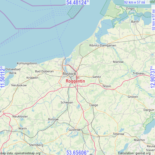
| Map corner | latitude | longitude |
|---|---|---|
| Upper-left | 54.48124°, | 11.50112° |
| Center: | 54.0707°, | 12.20424° |
| Lower-right: | 53.65606°, | 12.90737° |
| Map W x H: | 91.8×91.7 km | = 57×57mi |
| max Lat: | 55.01917° ⇑6.5% North |
| Roggentin: | 54.0707° |
| min Lat: | ⇓93.5% South 47.40724° |
| min Long | Roggentin | max Long |
| 5.92978° | 12.20424° | 14.98853° |
| W 84.7%⇐ | ⇒15.3% E |
Elevation
Elevation of Roggentin is 33 m = 108 ft, and this is 216.1 m = 709 ft below average elevation for this country.
| Max E: |
1256 m = 4121 ft | 85.8% |
| Avg. | 249.1 m = 817 ft | |
| Roggentin | 33 m = 108 ft | |
Min E: |
-5 m = -16 ft | 14.2% |
See also: Germany elevation on elevation.city.
Geographical zone
Roggentin is located in North temperate zone (between Tropic of Cancer and the Arctic Circle). Distance of this North polar circle is 1389.1 km =863.1 mi to North.| Distance of | km | miles | from Roggentin |
|---|---|---|---|
| North Pole | 3995 | 2482.4 | to North |
| Arctic Circle | 1389.1 | 863.1 | to North |
| Tropic Cancer | 3406.2 | 2116.5 | to South |
| Equator | 6012.1 | 3735.7 | to South |


Nearby cities:
15 places around Roggentin: (largest is in red/bold)
• Bentwisch
4.9 km =3 mi,  0°
0°
• Broderstorf
4 km =2.5 mi,  73°
73°
• Damm
7.6 km =4.7 mi,  206°
206°
• Dierkow-Neu
4.6 km =2.9 mi,  328°
328°
• Dierkow-West
5.3 km =3.3 mi,  318°
318°
• Dummerstorf
6.4 km =4 mi,  165°
165°
• Kavelstorf
7.3 km =4.5 mi,  186°
186°
• Klein Kussewitz
7.4 km =4.6 mi,  19°
19°
• Lieblingshof
9.3 km =5.8 mi,  119°
119°
• Mönchhagen
9 km =5.6 mi,  5°
5°
• Nienhagen
8.9 km =5.5 mi,  347°
347°
• Papendorf
6.1 km =3.8 mi,  229°
229°
• Prisannewitz
9.5 km =5.9 mi, 174°
• Rostock
4.6 km =2.9 mi,  295°
295°
• Thulendorf
6.9 km =4.3 mi, 67°
Sources, notices
• [Note1] Compared only with cities in Germany existing in our database
• [Src1] Map data: © OpenStreetMap contributors (CC-BY-SA)
• [Src2] Other city data from geonames.org with taken over terms of usage.
• [Src3] Geographical zone / Annual Mean Temperature by Robert A. Rohde @ Wikipedia
