Ringleben geodata
Ringleben (Thuringia) is a seat of a fourth-order administrative division; located in Germany in Europe/Berlin (GMT+2) time zone. With population of 587 people, there are 8889 cities with bigger population in this country. Compared to other cities in Germany, 59.9% of cities are located further ↓South; 66.2% of cities are located further ←West and 60.4% of cities have higher elevation than Ringleben. Note1


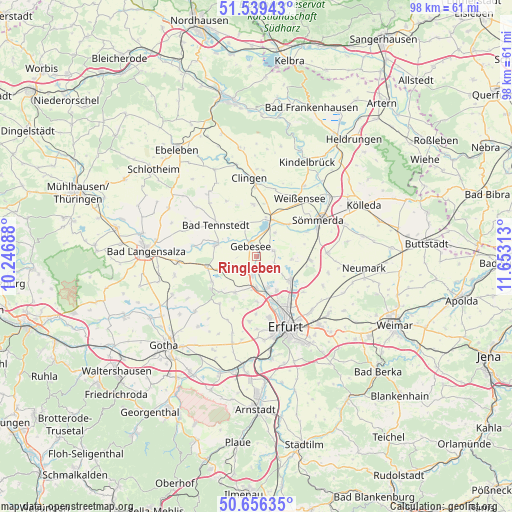
Ringleben GPS coordinates[2]
51° 6' 0" North, 10° 57' 0" East
| Map corner | latitude | longitude |
|---|---|---|
| Upper-left | 51.53943°, | 10.24688° |
| Center: | 51.1°, | 10.95° |
| Lower-right: | 50.65635°, | 11.65313° |
| Map W x H: | 98.2×98.2 km | = 61×61mi |
| max Lat: | 55.01917° ⇑40.1% North |
| Ringleben: | 51.1° |
| min Lat: | ⇓59.9% South 47.40724° |
| min Long | Ringleben | max Long |
| 5.92978° | 10.95° | 14.98853° |
| W 66.2%⇐ | ⇒33.8% E |
Elevation
Elevation of Ringleben is 149 m = 489 ft, and this is 100.1 m = 328 ft below average elevation for this country.
| Max E: |
1256 m = 4121 ft | 60.4% |
| Avg. | 249.1 m = 817 ft | |
| Ringleben | 149 m = 489 ft | |
Min E: |
-5 m = -16 ft | 39.6% |
See also: Germany elevation on elevation.city.
Geographical zone
Ringleben is located in North temperate zone (between Tropic of Cancer and the Arctic Circle). Distance of this North polar circle is 1719.4 km =1068.4 mi to North.| Distance of | km | miles | from Ringleben |
|---|---|---|---|
| North Pole | 4325.3 | 2687.6 | to North |
| Arctic Circle | 1719.4 | 1068.4 | to North |
| Tropic Cancer | 3075.9 | 1911.3 | to South |
| Equator | 5681.8 | 3530.5 | to South |


Nearby cities:
15 places around Ringleben: (largest is in red/bold)
• Alperstedt
6.7 km =4.2 mi,  97°
97°
• Andisleben
2.5 km =1.6 mi,  218°
218°
• Dachwig
7.1 km =4.4 mi,  249°
249°
• Elxleben
5.6 km =3.5 mi,  180°
180°
• Gebesee
2 km =1.2 mi,  326°
326°
• Haßleben
3.4 km =2.1 mi,  73°
73°
• Henschleben
3.9 km =2.4 mi,  17°
17°
• Herbsleben
8.4 km =5.2 mi,  282°
282°
• Nöda
6 km =3.7 mi,  128°
128°
• Riethnordhausen
4 km =2.5 mi,  117°
117°
• Schwerstedt
6.5 km =4 mi,  341°
341°
• Straußfurt
7.8 km =4.8 mi, 17°
• Walschleben
3.9 km =2.4 mi,  197°
197°
• Werningshausen
5.7 km =3.5 mi,  39°
39°
• Witterda
8.2 km =5.1 mi,  210°
210°
Sources, notices
• [Note1] Compared only with cities in Germany existing in our database
• [Src1] Map data: © OpenStreetMap contributors (CC-BY-SA)
• [Src2] Other city data from geonames.org with taken over terms of usage.
• [Src3] Geographical zone / Annual Mean Temperature by Robert A. Rohde @ Wikipedia
