Rethen geodata
Rethen (Lower Saxony) is a populated place; located in Germany in Europe/Berlin (GMT+2) time zone. With population of 1,137 people, there are 6743 cities with bigger population in this country. Compared to other cities in Germany, 75.9% of cities are located further ↓South; 58.5% of cities are located further ←West and 72.1% of cities have higher elevation than Rethen. Note1


Rethen GPS coordinates[2]
52° 22' 37.452" North, 10° 28' 42.78" East
| Map corner | latitude | longitude |
|---|---|---|
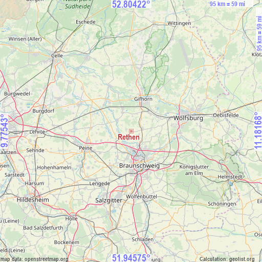
| Upper-left | 52.80422°, | 9.77543° |
| Center: | 52.37707°, | 10.47855° |
| Lower-right: | 51.94575°, | 11.18168° |
| Map W x H: | 95.5×95.5 km | = 59.3×59.3mi |
| max Lat: | 55.01917° ⇑24.1% North |
| Rethen: | 52.37707° |
| min Lat: | ⇓75.9% South 47.40724° |
| min Long | Rethen | max Long |
| 5.92978° | 10.47855° | 14.98853° |
| W 58.5%⇐ | ⇒41.5% E |
Elevation
Elevation of Rethen is 77 m = 253 ft, and this is 172.1 m = 565 ft below average elevation for this country.
| Max E: |
1256 m = 4121 ft | 72.1% |
| Avg. | 249.1 m = 817 ft | |
| Rethen | 77 m = 253 ft | |
Min E: |
-5 m = -16 ft | 27.9% |
See also: Germany elevation on elevation.city.
Geographical zone
Rethen is located in North temperate zone (between Tropic of Cancer and the Arctic Circle). Distance of this North polar circle is 1577.4 km =980.2 mi to North.| Distance of | km | miles | from Rethen |
|---|---|---|---|
| North Pole | 4183.3 | 2599.4 | to North |
| Arctic Circle | 1577.4 | 980.2 | to North |
| Tropic Cancer | 3217.9 | 1999.5 | to South |
| Equator | 5823.8 | 3618.7 | to South |


Nearby cities:
15 places around Rethen: (largest is in red/bold)
• Abbesbüttel
6 km =3.7 mi,  117°
117°
• Adenbüttel
1.9 km =1.2 mi,  279°
279°
• Bechtsbüttel
6 km =3.7 mi,  135°
135°
• Bevenrode
7.9 km =4.9 mi, 121°
• Didderse
5.1 km =3.2 mi,  274°
274°
• Hillerse
6.9 km =4.3 mi,  309°
309°
• Klein Schwülper
5.2 km =3.2 mi,  220°
220°
• Leiferde
7.6 km =4.7 mi,  336°
336°
• Meine
4.2 km =2.6 mi,  78°
78°
• Neubrück
4.2 km =2.6 mi,  260°
260°
• Ribbesbüttel
6.7 km =4.2 mi,  18°
18°
• Rötgesbüttel
5.8 km =3.6 mi,  40°
40°
• Vordorf
3.1 km =1.9 mi,  114°
114°
• Wasbüttel
8.8 km =5.5 mi,  62°
62°
• Wendeburg
7.9 km =4.9 mi,  227°
227°
Sources, notices
• [Note1] Compared only with cities in Germany existing in our database
• [Src1] Map data: © OpenStreetMap contributors (CC-BY-SA)
• [Src2] Other city data from geonames.org with taken over terms of usage.
• [Src3] Geographical zone / Annual Mean Temperature by Robert A. Rohde @ Wikipedia
