Rengsdorf geodata
Rengsdorf (Rheinland-Pfalz) is a seat of a fourth-order administrative division; located in Germany in Europe/Berlin (GMT+2) time zone. With population of 2,671 people, there are 4259 cities with bigger population in this country. Compared to other cities in Germany, 52.8% of cities are located further ↑North; 87.1% of cities are located further →East and 56.5% of cities have lower elevation than Rengsdorf. Note1


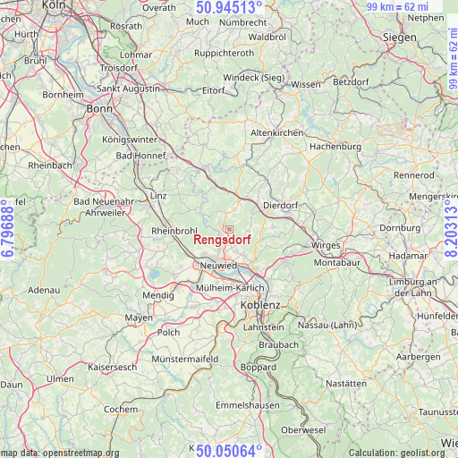
Rengsdorf GPS coordinates[2]
50° 30' 0" North, 7° 30' 0" East
| Map corner | latitude | longitude |
|---|---|---|
| Upper-left | 50.94513°, | 6.79688° |
| Center: | 50.5°, | 7.5° |
| Lower-right: | 50.05064°, | 8.20313° |
| Map W x H: | 99.5×99.5 km | = 61.8×61.8mi |
| max Lat: | 55.01917° ⇑52.8% North |
| Rengsdorf: | 50.5° |
| min Lat: | ⇓47.2% South 47.40724° |
| min Long | Rengsdorf | max Long |
| 5.92978° | 7.5° | 14.98853° |
| W 12.9%⇐ | ⇒87.1% E |
Elevation
Elevation of Rengsdorf is 269 m = 883 ft, and this is 19.9 m = 65 ft above average elevation for this country.
| Max E: |
1256 m = 4121 ft | 43.5% |
| Rengsdorf | 269 m 883 ft | |
| Avg. | 249.1 m = 817 ft | |
Min E: |
-5 m = -16 ft | 56.5% |
See also: Germany elevation on elevation.city.
Geographical zone
Rengsdorf is located in North temperate zone (between Tropic of Cancer and the Arctic Circle). Distance of this North polar circle is 1786.1 km =1109.8 mi to North.| Distance of | km | miles | from Rengsdorf |
|---|---|---|---|
| North Pole | 4392 | 2729.1 | to North |
| Arctic Circle | 1786.1 | 1109.8 | to North |
| Tropic Cancer | 3009.2 | 1869.8 | to South |
| Equator | 5615.1 | 3489.1 | to South |


Nearby cities:
15 places around Rengsdorf: (largest is in red/bold)
• Anhausen
3.5 km =2.2 mi,  90°
90°
• Bonefeld
2.8 km =1.7 mi,  344°
344°
• Datzeroth
6.2 km =3.9 mi,  287°
287°
• Ehlscheid
2.9 km =1.8 mi,  304°
304°
• Hardert
2.2 km =1.4 mi,  32°
32°
• Heimbach
6 km =3.7 mi,  157°
157°
• Isenburg
7.3 km =4.5 mi,  104°
104°
• Kurtscheid
4.4 km =2.7 mi,  327°
327°
• Meinborn
4.7 km =2.9 mi, 90°
• Melsbach
2.2 km =1.4 mi,  212°
212°
• Niederbreitbach
6.5 km =4 mi, 301°
• Oberhonnefeld-Gierend
6.4 km =4 mi,  14°
14°
• Oberraden
6 km =3.7 mi,  22°
22°
• Rüscheid
6 km =3.7 mi,  51°
51°
• Thalhausen
5.9 km =3.7 mi, 90°
Sources, notices
• [Note1] Compared only with cities in Germany existing in our database
• [Src1] Map data: © OpenStreetMap contributors (CC-BY-SA)
• [Src2] Other city data from geonames.org with taken over terms of usage.
• [Src3] Geographical zone / Annual Mean Temperature by Robert A. Rohde @ Wikipedia
