Oberraden geodata
Oberraden (Rheinland-Pfalz) is a seat of a fourth-order administrative division; located in Germany in Europe/Berlin (GMT+2) time zone. With population of 645 people, there are 8580 cities with bigger population in this country. Compared to other cities in Germany, 51.7% of cities are located further ↑North; 86.4% of cities are located further →East and 67.4% of cities have lower elevation than Oberraden. Note1


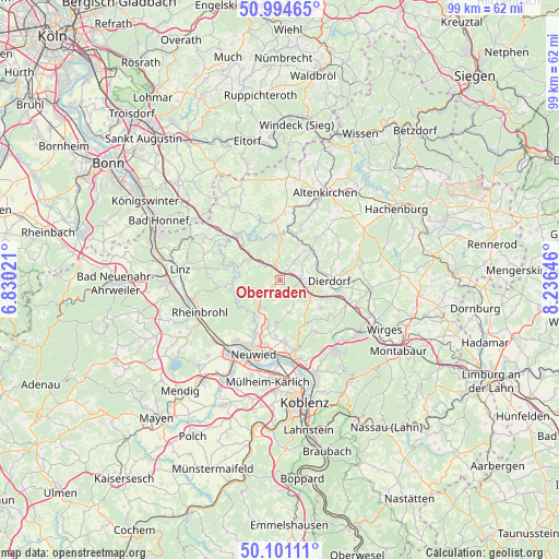
Oberraden GPS coordinates[2]
50° 33' 0" North, 7° 31' 59.988" East
| Map corner | latitude | longitude |
|---|---|---|
| Upper-left | 50.99465°, | 6.83021° |
| Center: | 50.55°, | 7.53333° |
| Lower-right: | 50.10111°, | 8.23646° |
| Map W x H: | 99.4×99.4 km | = 61.8×61.8mi |
| max Lat: | 55.01917° ⇑51.7% North |
| Oberraden: | 50.55° |
| min Lat: | ⇓48.3% South 47.40724° |
| min Long | Oberraden | max Long |
| 5.92978° | 7.53333° | 14.98853° |
| W 13.6%⇐ | ⇒86.4% E |
Elevation
Elevation of Oberraden is 338 m = 1109 ft, and this is 88.9 m = 292 ft above average elevation for this country.
| Max E: |
1256 m = 4121 ft | 32.6% |
| Oberraden | 338 m 1109 ft | |
| Avg. | 249.1 m = 817 ft | |
Min E: |
-5 m = -16 ft | 67.4% |
See also: Germany elevation on elevation.city.
Geographical zone
Oberraden is located in North temperate zone (between Tropic of Cancer and the Arctic Circle). Distance of this North polar circle is 1780.5 km =1106.4 mi to North.| Distance of | km | miles | from Oberraden |
|---|---|---|---|
| North Pole | 4386.4 | 2725.6 | to North |
| Arctic Circle | 1780.5 | 1106.4 | to North |
| Tropic Cancer | 3014.7 | 1873.2 | to South |
| Equator | 5620.6 | 3492.5 | to South |


Nearby cities:
15 places around Oberraden: (largest is in red/bold)
• Bonefeld
4.3 km =2.7 mi,  226°
226°
• Dernbach
4.7 km =2.9 mi,  90°
90°
• Güllesheim
5.3 km =3.3 mi,  356°
356°
• Hardert
3.9 km =2.4 mi,  197°
197°
• Horhausen
4.2 km =2.6 mi, 357°
• Krunkel
4.4 km =2.7 mi,  327°
327°
• Kurtscheid
5.1 km =3.2 mi,  248°
248°
• Linkenbach
3.9 km =2.4 mi,  17°
17°
• Niederhofen
5.1 km =3.2 mi,  68°
68°
• Oberhonnefeld-Gierend
1 km =0.6 mi,  310°
310°
• Obersteinebach
5.1 km =3.2 mi,  316°
316°
• Pleckhausen
5 km =3.1 mi,  7°
7°
• Rüscheid
3 km =1.9 mi,  128°
128°
• Urbach-Überdorf
3.9 km =2.4 mi,  78°
78°
• Willroth
2.2 km =1.4 mi,  349°
349°
Sources, notices
• [Note1] Compared only with cities in Germany existing in our database
• [Src1] Map data: © OpenStreetMap contributors (CC-BY-SA)
• [Src2] Other city data from geonames.org with taken over terms of usage.
• [Src3] Geographical zone / Annual Mean Temperature by Robert A. Rohde @ Wikipedia
