Rantrum geodata
Rantrum (Schleswig-Holstein) is a seat of a fourth-order administrative division; located in Germany in Europe/Berlin (GMT+2) time zone. With population of 1,562 people, there are 5759 cities with bigger population in this country. Compared to other cities in Germany, 97.7% of cities are located further ↓South; 63.6% of cities are located further →East and 95.2% of cities have higher elevation than Rantrum. Note1
Administrative division(s):
- Level 1: Schleswig-Holstein
- Level 3: Kreis Nordfriesland
- Level 4: Rantrum


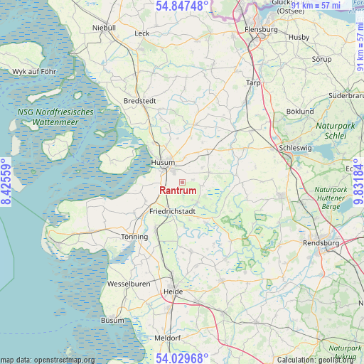
Rantrum GPS coordinates[2]
54° 26' 26.232" North, 9° 7' 43.392" East
| Map corner | latitude | longitude |
|---|---|---|
| Upper-left | 54.84748°, | 8.42559° |
| Center: | 54.44062°, | 9.12872° |
| Lower-right: | 54.02968°, | 9.83184° |
| Map W x H: | 90.9×90.9 km | = 56.5×56.5mi |
| max Lat: | 55.01917° ⇑2.3% North |
| Rantrum: | 54.44062° |
| min Lat: | ⇓97.7% South 47.40724° |
| min Long | Rantrum | max Long |
| 5.92978° | 9.12872° | 14.98853° |
| W 36.4%⇐ | ⇒63.6% E |
Elevation
Elevation of Rantrum is 8 m = 26 ft, and this is 241.1 m = 791 ft below average elevation for this country.
| Max E: |
1256 m = 4121 ft | 95.2% |
| Avg. | 249.1 m = 817 ft | |
| Rantrum | 8 m = 26 ft | |
Min E: |
-5 m = -16 ft | 4.8% |
See also: Germany elevation on elevation.city.
Geographical zone
Rantrum is located in North temperate zone (between Tropic of Cancer and the Arctic Circle). Distance of this North polar circle is 1347.9 km =837.5 mi to North.| Distance of | km | miles | from Rantrum |
|---|---|---|---|
| North Pole | 3953.8 | 2456.8 | to North |
| Arctic Circle | 1347.9 | 837.5 | to North |
| Tropic Cancer | 3447.3 | 2142.1 | to South |
| Equator | 6053.2 | 3761.3 | to South |


Nearby cities:
15 places around Rantrum: (largest is in red/bold)
• Friedrichstadt
7.7 km =4.8 mi,  200°
200°
• Hude
8.5 km =5.3 mi,  138°
138°
• Husum
7 km =4.3 mi,  315°
315°
• Koldenbüttel
7.5 km =4.7 mi,  212°
212°
• Mildstedt
3.4 km =2.1 mi,  327°
327°
• Oldersbek
2.7 km =1.7 mi,  75°
75°
• Ostenfeld
7.3 km =4.5 mi,  69°
69°
• Ramstedt
5.1 km =3.2 mi,  151°
151°
• Schwabstedt
6.1 km =3.8 mi, 142°
• Schwesing
6 km =3.7 mi,  3°
3°
• Seeth
8.6 km =5.3 mi,  163°
163°
• Wester-Ohrstedt
8.3 km =5.2 mi,  26°
26°
• Winnert
4.7 km =2.9 mi,  99°
99°
• Wisch
3 km =1.9 mi, 152°
• Wittbek
5.4 km =3.4 mi,  57°
57°
Sources, notices
• [Note1] Compared only with cities in Germany existing in our database
• [Src1] Map data: © OpenStreetMap contributors (CC-BY-SA)
• [Src2] Other city data from geonames.org with taken over terms of usage.
• [Src3] Geographical zone / Annual Mean Temperature by Robert A. Rohde @ Wikipedia
