Ostenfeld geodata
Ostenfeld (Schleswig-Holstein) is a populated place; located in Germany in Europe/Berlin (GMT+2) time zone. With population of 1,512 people, there are 5859 cities with bigger population in this country. Compared to other cities in Germany, 97.8% of cities are located further ↓South; 61.7% of cities are located further →East and 80.2% of cities have higher elevation than Ostenfeld. Note1
Administrative division(s):
- Level 1: Schleswig-Holstein
- Level 3: Kreis Nordfriesland
- Level 4: Ostenfeld (Husum)


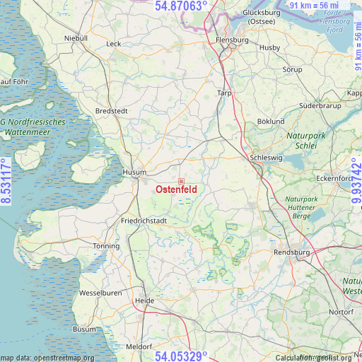
Ostenfeld GPS coordinates[2]
54° 27' 50.4" North, 9° 14' 3.48" East
| Map corner | latitude | longitude |
|---|---|---|
| Upper-left | 54.87063°, | 8.53117° |
| Center: | 54.464°, | 9.2343° |
| Lower-right: | 54.05329°, | 9.93742° |
| Map W x H: | 90.9×90.9 km | = 56.5×56.5mi |
| max Lat: | 55.01917° ⇑2.2% North |
| Ostenfeld: | 54.464° |
| min Lat: | ⇓97.8% South 47.40724° |
| min Long | Ostenfeld | max Long |
| 5.92978° | 9.2343° | 14.98853° |
| W 38.3%⇐ | ⇒61.7% E |
Elevation
Elevation of Ostenfeld is 46 m = 151 ft, and this is 203.1 m = 666 ft below average elevation for this country.
| Max E: |
1256 m = 4121 ft | 80.2% |
| Avg. | 249.1 m = 817 ft | |
| Ostenfeld | 46 m = 151 ft | |
Min E: |
-5 m = -16 ft | 19.8% |
See also: Germany elevation on elevation.city.
Geographical zone
Ostenfeld is located in North temperate zone (between Tropic of Cancer and the Arctic Circle). Distance of this North polar circle is 1345.3 km =835.9 mi to North.| Distance of | km | miles | from Ostenfeld |
|---|---|---|---|
| North Pole | 3951.2 | 2455.2 | to North |
| Arctic Circle | 1345.3 | 835.9 | to North |
| Tropic Cancer | 3449.9 | 2143.7 | to South |
| Equator | 6055.8 | 3762.9 | to South |


Nearby cities:
15 places around Ostenfeld: (largest is in red/bold)
• Ahrenviöl
7.7 km =4.8 mi,  346°
346°
• Fresendelf
7.9 km =4.9 mi,  174°
174°
• Hollingstedt
6.7 km =4.2 mi,  94°
94°
• Oldersbek
4.6 km =2.9 mi,  245°
245°
• Oster-Ohrstedt
5.7 km =3.5 mi, 351°
• Rantrum
7.3 km =4.5 mi, 249°
• Schwabstedt
8.1 km =5 mi,  202°
202°
• Schwesing
7.3 km =4.5 mi,  298°
298°
• Treia
6.7 km =4.2 mi,  53°
53°
• Wester-Ohrstedt
5.8 km =3.6 mi,  327°
327°
• Westerholz
3.8 km =2.4 mi,  40°
40°
• Winnert
4.1 km =2.5 mi,  213°
213°
• Wisch
7.6 km =4.7 mi,  226°
226°
• Wittbek
2.2 km =1.4 mi,  277°
277°
• Wohlde
7.7 km =4.8 mi,  147°
147°
Sources, notices
• [Note1] Compared only with cities in Germany existing in our database
• [Src1] Map data: © OpenStreetMap contributors (CC-BY-SA)
• [Src2] Other city data from geonames.org with taken over terms of usage.
• [Src3] Geographical zone / Annual Mean Temperature by Robert A. Rohde @ Wikipedia
