Friedrichstadt geodata
Friedrichstadt (Schleswig-Holstein) is a populated place; located in Germany in Europe/Berlin (GMT+2) time zone. With population of 2,548 people, there are 4382 cities with bigger population in this country. Compared to other cities in Germany, 97.1% of cities are located further ↓South; 64.2% of cities are located further →East and 97.6% of cities have higher elevation than Friedrichstadt. Note1
Administrative division(s):
- Level 1: Schleswig-Holstein
- Level 3: Kreis Nordfriesland
- Level 4: Friedrichstadt


Friedrichstadt GPS coordinates[2]
54° 22' 32.376" North, 9° 5' 12.192" East
| Map corner | latitude | longitude |
|---|---|---|
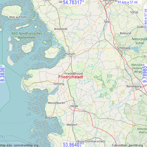
| Upper-left | 54.78317°, | 8.3836° |
| Center: | 54.37566°, | 9.08672° |
| Lower-right: | 53.96407°, | 9.78985° |
| Map W x H: | 91.1×91.1 km | = 56.6×56.6mi |
| max Lat: | 55.01917° ⇑2.9% North |
| Friedrichstadt: | 54.37566° |
| min Lat: | ⇓97.1% South 47.40724° |
| min Long | Friedrichstadt | max Long |
| 5.92978° | 9.08672° | 14.98853° |
| W 35.8%⇐ | ⇒64.2% E |
Elevation
Elevation of Friedrichstadt is 3 m = 10 ft, and this is 246.1 m = 807 ft below average elevation for this country.
| Max E: |
1256 m = 4121 ft | 97.6% |
| Avg. | 249.1 m = 817 ft | |
| Friedrichstadt | 3 m = 10 ft | |
Min E: |
-5 m = -16 ft | 2.4% |
See also: Germany elevation on elevation.city.
Geographical zone
Friedrichstadt is located in North temperate zone (between Tropic of Cancer and the Arctic Circle). Distance of this North polar circle is 1355.2 km =842.1 mi to North.| Distance of | km | miles | from Friedrichstadt |
|---|---|---|---|
| North Pole | 3961.1 | 2461.3 | to North |
| Arctic Circle | 1355.2 | 842.1 | to North |
| Tropic Cancer | 3440.1 | 2137.6 | to South |
| Equator | 6046 | 3756.8 | to South |


Nearby cities:
15 places around Friedrichstadt: (largest is in red/bold)
• Drage
5.1 km =3.2 mi,  115°
115°
• Hude
8.5 km =5.3 mi,  84°
84°
• Koldenbüttel
1.6 km =1 mi,  303°
303°
• Krempel
7.4 km =4.6 mi,  207°
207°
• Lehe
5.6 km =3.5 mi,  226°
226°
• Lunden
6.3 km =3.9 mi,  218°
218°
• Ramstedt
5.8 km =3.6 mi,  62°
62°
• Rantrum
7.7 km =4.8 mi,  20°
20°
• Sankt Annen
3.3 km =2.1 mi,  189°
189°
• Schlichting
7.2 km =4.5 mi,  178°
178°
• Schwabstedt
6.9 km =4.3 mi,  69°
69°
• Seeth
5.3 km =3.3 mi,  100°
100°
• Süderstapel
9 km =5.6 mi,  108°
108°
• Wisch
6.1 km =3.8 mi,  41°
41°
• Witzwort
7.2 km =4.5 mi,  292°
292°
Sources, notices
• [Note1] Compared only with cities in Germany existing in our database
• [Src1] Map data: © OpenStreetMap contributors (CC-BY-SA)
• [Src2] Other city data from geonames.org with taken over terms of usage.
• [Src3] Geographical zone / Annual Mean Temperature by Robert A. Rohde @ Wikipedia
