Pluwig geodata
Pluwig (Rheinland-Pfalz) is a seat of a fourth-order administrative division; located in Germany in Europe/Berlin (GMT+2) time zone. With population of 1,237 people, there are 6476 cities with bigger population in this country. Compared to other cities in Germany, 71.6% of cities are located further ↑North; 96.3% of cities are located further →East and 63.3% of cities have lower elevation than Pluwig. Note1
Administrative division(s):
- Level 1: Rheinland-Pfalz
- Level 3: Landkreis Trier-Saarburg
- Level 4: Pluwig


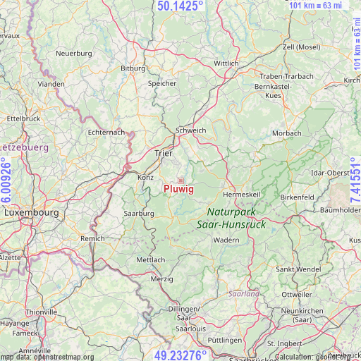
Pluwig GPS coordinates[2]
49° 41' 23.136" North, 6° 42' 44.604" East
| Map corner | latitude | longitude |
|---|---|---|
| Upper-left | 50.1425°, | 6.00926° |
| Center: | 49.68976°, | 6.71239° |
| Lower-right: | 49.23276°, | 7.41551° |
| Map W x H: | 101.2×101.2 km | = 62.9×62.9mi |
| max Lat: | 55.01917° ⇑71.6% North |
| Pluwig: | 49.68976° |
| min Lat: | ⇓28.4% South 47.40724° |
| min Long | Pluwig | max Long |
| 5.92978° | 6.71239° | 14.98853° |
| W 3.7%⇐ | ⇒96.3% E |
Elevation
Elevation of Pluwig is 310 m = 1017 ft, and this is 60.9 m = 200 ft above average elevation for this country.
| Max E: |
1256 m = 4121 ft | 36.7% |
| Pluwig | 310 m 1017 ft | |
| Avg. | 249.1 m = 817 ft | |
Min E: |
-5 m = -16 ft | 63.3% |
See also: Germany elevation on elevation.city.
Geographical zone
Pluwig is located in North temperate zone (between Tropic of Cancer and the Arctic Circle). Distance of this North polar circle is 1876.2 km =1165.8 mi to North.| Distance of | km | miles | from Pluwig |
|---|---|---|---|
| North Pole | 4482.1 | 2785 | to North |
| Arctic Circle | 1876.2 | 1165.8 | to North |
| Tropic Cancer | 2919.1 | 1813.8 | to South |
| Equator | 5525 | 3433.1 | to South |


Nearby cities:
15 places around Pluwig: (largest is in red/bold)
• Franzenheim
2.2 km =1.4 mi,  251°
251°
• Gusterath
1.2 km =0.7 mi,  15°
15°
• Gutweiler
3.3 km =2.1 mi,  26°
26°
• Heddert
5.2 km =3.2 mi,  148°
148°
• Hinzenburg
3 km =1.9 mi, 149°
• Hockweiler
2.1 km =1.3 mi,  315°
315°
• Holzerath
3.7 km =2.3 mi,  108°
108°
• Irsch
4.2 km =2.6 mi,  345°
345°
• Korlingen
4.3 km =2.7 mi,  12°
12°
• Lampaden
4.5 km =2.8 mi,  191°
191°
• Morscheid
5.5 km =3.4 mi, 29°
• Ollmuth
2.6 km =1.6 mi,  173°
173°
• Pellingen
3.4 km =2.1 mi,  242°
242°
• Riveris
4.9 km =3 mi,  52°
52°
• Sommerau
3.3 km =2.1 mi, 26°
Sources, notices
• [Note1] Compared only with cities in Germany existing in our database
• [Src1] Map data: © OpenStreetMap contributors (CC-BY-SA)
• [Src2] Other city data from geonames.org with taken over terms of usage.
• [Src3] Geographical zone / Annual Mean Temperature by Robert A. Rohde @ Wikipedia
