Gutweiler geodata
Gutweiler (Rheinland-Pfalz) is a seat of a fourth-order administrative division; located in Germany in Europe/Berlin (GMT+2) time zone. With population of 679 people, there are 8428 cities with bigger population in this country. Compared to other cities in Germany, 71.1% of cities are located further ↑North; 96.2% of cities are located further →East and 53.8% of cities have higher elevation than Gutweiler. Note1
Administrative division(s):
- Level 1: Rheinland-Pfalz
- Level 3: Landkreis Trier-Saarburg
- Level 4: Gutweiler


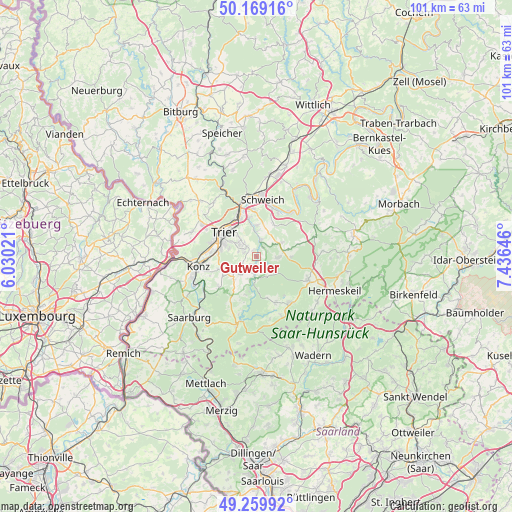
Gutweiler GPS coordinates[2]
49° 43' 0.012" North, 6° 43' 59.988" East
| Map corner | latitude | longitude |
|---|---|---|
| Upper-left | 50.16916°, | 6.03021° |
| Center: | 49.71667°, | 6.73333° |
| Lower-right: | 49.25992°, | 7.43646° |
| Map W x H: | 101.1×101.1 km | = 62.8×62.8mi |
| max Lat: | 55.01917° ⇑71.1% North |
| Gutweiler: | 49.71667° |
| min Lat: | ⇓28.9% South 47.40724° |
| min Long | Gutweiler | max Long |
| 5.92978° | 6.73333° | 14.98853° |
| W 3.8%⇐ | ⇒96.2% E |
Elevation
Elevation of Gutweiler is 198 m = 650 ft, and this is 51.1 m = 168 ft below average elevation for this country.
| Max E: |
1256 m = 4121 ft | 53.8% |
| Avg. | 249.1 m = 817 ft | |
| Gutweiler | 198 m = 650 ft | |
Min E: |
-5 m = -16 ft | 46.2% |
See also: Germany elevation on elevation.city.
Geographical zone
Gutweiler is located in North temperate zone (between Tropic of Cancer and the Arctic Circle). Distance of this North polar circle is 1873.2 km =1164 mi to North.| Distance of | km | miles | from Gutweiler |
|---|---|---|---|
| North Pole | 4479.1 | 2783.2 | to North |
| Arctic Circle | 1873.2 | 1164 | to North |
| Tropic Cancer | 2922.1 | 1815.7 | to South |
| Equator | 5528 | 3434.9 | to South |


Nearby cities:
15 places around Gutweiler: (largest is in red/bold)
• Franzenheim
5.2 km =3.2 mi,  224°
224°
• Gusterath
2.2 km =1.4 mi,  212°
212°
• Hinzenburg
5.6 km =3.5 mi,  180°
180°
• Hockweiler
3.3 km =2.1 mi,  243°
243°
• Holzerath
4.6 km =2.9 mi,  154°
154°
• Irsch
2.7 km =1.7 mi,  292°
292°
• Kasel
5 km =3.1 mi,  359°
359°
• Korlingen
1.3 km =0.8 mi,  332°
332°
• Morscheid
2.2 km =1.4 mi,  32°
32°
• Ollmuth
5.7 km =3.5 mi,  192°
192°
• Osburg
3.6 km =2.2 mi,  90°
90°
• Pluwig
3.3 km =2.1 mi, 206°
• Riveris
2.4 km =1.5 mi, 90°
• Sommerau
0 km =0 mi,  0°
0°
• Waldrach
3.4 km =2.1 mi,  14°
14°
Sources, notices
• [Note1] Compared only with cities in Germany existing in our database
• [Src1] Map data: © OpenStreetMap contributors (CC-BY-SA)
• [Src2] Other city data from geonames.org with taken over terms of usage.
• [Src3] Geographical zone / Annual Mean Temperature by Robert A. Rohde @ Wikipedia
