Ornbau geodata
Ornbau (Bavaria) is a populated place; located in Germany in Europe/Berlin (GMT+2) time zone. With population of 1,730 people, there are 5459 cities with bigger population in this country. Compared to other cities in Germany, 80.7% of cities are located further ↑North; 61.8% of cities are located further ←West and 78.2% of cities have lower elevation than Ornbau. Note1
Administrative division(s):
- Level 1: Bavaria
- Level 2: Regierungsbezirk Mittelfranken
- Level 3: Landkreis Ansbach
- Level 4: Ornbau


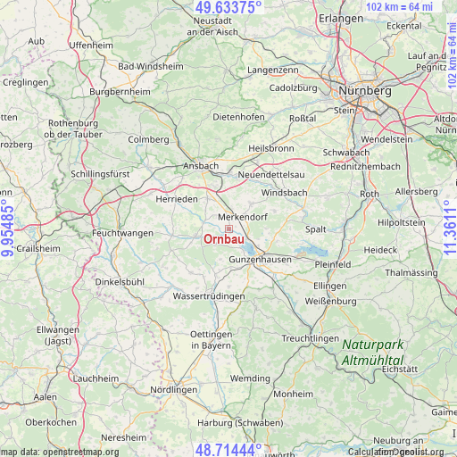
Ornbau GPS coordinates[2]
49° 10' 34.428" North, 10° 39' 28.692" East
| Map corner | latitude | longitude |
|---|---|---|
| Upper-left | 49.63375°, | 9.95485° |
| Center: | 49.17623°, | 10.65797° |
| Lower-right: | 48.71444°, | 11.3611° |
| Map W x H: | 102.2×102.2 km | = 63.5×63.5mi |
| max Lat: | 55.01917° ⇑80.7% North |
| Ornbau: | 49.17623° |
| min Lat: | ⇓19.3% South 47.40724° |
| min Long | Ornbau | max Long |
| 5.92978° | 10.65797° | 14.98853° |
| W 61.8%⇐ | ⇒38.2% E |
Elevation
Elevation of Ornbau is 421 m = 1381 ft, and this is 171.9 m = 564 ft above average elevation for this country.
| Max E: |
1256 m = 4121 ft | 21.8% |
| Ornbau | 421 m 1381 ft | |
| Avg. | 249.1 m = 817 ft | |
Min E: |
-5 m = -16 ft | 78.2% |
See also: Germany elevation on elevation.city.
Geographical zone
Ornbau is located in North temperate zone (between Tropic of Cancer and the Arctic Circle). Distance of this North polar circle is 1933.3 km =1201.3 mi to North.| Distance of | km | miles | from Ornbau |
|---|---|---|---|
| North Pole | 4539.2 | 2820.5 | to North |
| Arctic Circle | 1933.3 | 1201.3 | to North |
| Tropic Cancer | 2862 | 1778.4 | to South |
| Equator | 5467.9 | 3397.6 | to South |


Nearby cities:
15 places around Ornbau: (largest is in red/bold)
• Arberg
4.6 km =2.9 mi,  219°
219°
• Burgoberbach
8.3 km =5.2 mi,  319°
319°
• Ehingen
13.1 km =8.1 mi, 220°
• Gnotzheim
13.5 km =8.4 mi,  162°
162°
• Gunzenhausen
9.9 km =6.2 mi,  131°
131°
• Haundorf
8.2 km =5.1 mi,  90°
90°
• Herrieden
13.1 km =8.1 mi,  301°
301°
• Merkendorf
4.5 km =2.8 mi,  47°
47°
• Mitteleschenbach
10.9 km =6.8 mi,  68°
68°
• Muhr am See
5 km =3.1 mi,  118°
118°
• Sachsen
12.6 km =7.8 mi,  0°
0°
• Unterschwaningen
11 km =6.8 mi,  193°
193°
• Weidenbach
2.6 km =1.6 mi,  338°
338°
• Wieseth
12.7 km =7.9 mi,  265°
265°
• Wolframs-Eschenbach
7.6 km =4.7 mi,  42°
42°
Sources, notices
• [Note1] Compared only with cities in Germany existing in our database
• [Src1] Map data: © OpenStreetMap contributors (CC-BY-SA)
• [Src2] Other city data from geonames.org with taken over terms of usage.
• [Src3] Geographical zone / Annual Mean Temperature by Robert A. Rohde @ Wikipedia
