Öllingen geodata
Öllingen (Baden-Württemberg) is a seat of a fourth-order administrative division; located in Germany in Europe/Berlin (GMT+2) time zone. With population of 512 people, there are 9314 cities with bigger population in this country. Compared to other cities in Germany, 88.8% of cities are located further ↑North; 52.4% of cities are located further ←West and 90.6% of cities have lower elevation than Öllingen. Note1
Administrative division(s):
- Level 1: Baden-Württemberg
- Level 2: Tübingen Region
- Level 3: Alb-Donau-Kreis
- Level 4: Öllingen


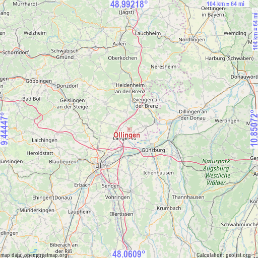
Öllingen GPS coordinates[2]
48° 31' 43.248" North, 10° 8' 51.324" East
| Map corner | latitude | longitude |
|---|---|---|
| Upper-left | 48.99218°, | 9.44447° |
| Center: | 48.52868°, | 10.14759° |
| Lower-right: | 48.0609°, | 10.85072° |
| Map W x H: | 103.5×103.5 km | = 64.3×64.3mi |
| max Lat: | 55.01917° ⇑88.8% North |
| Öllingen: | 48.52868° |
| min Lat: | ⇓11.2% South 47.40724° |
| min Long | Öllingen | max Long |
| 5.92978° | 10.14759° | 14.98853° |
| W 52.4%⇐ | ⇒47.6% E |
Elevation
Elevation of Öllingen is 521 m = 1709 ft, and this is 271.9 m = 892 ft above average elevation for this country.
| Max E: |
1256 m = 4121 ft | 9.4% |
| Öllingen | 521 m 1709 ft | |
| Avg. | 249.1 m = 817 ft | |
Min E: |
-5 m = -16 ft | 90.6% |
See also: Germany elevation on elevation.city.
Geographical zone
Öllingen is located in North temperate zone (between Tropic of Cancer and the Arctic Circle). Distance of this North polar circle is 2005.3 km =1246 mi to North.| Distance of | km | miles | from Öllingen |
|---|---|---|---|
| North Pole | 4611.2 | 2865.3 | to North |
| Arctic Circle | 2005.3 | 1246 | to North |
| Tropic Cancer | 2790 | 1733.6 | to South |
| Equator | 5395.9 | 3352.9 | to South |


Nearby cities:
15 places around Öllingen: (largest is in red/bold)
• Asselfingen
3.2 km =2 mi,  88°
88°
• Ballendorf
5.9 km =3.7 mi,  298°
298°
• Bernstadt
9.5 km =5.9 mi,  250°
250°
• Börslingen
6.3 km =3.9 mi,  280°
280°
• Herbrechtingen
10.6 km =6.6 mi,  11°
11°
• Hermaringen
11.1 km =6.9 mi,  48°
48°
• Holzkirch
11.2 km =7 mi,  271°
271°
• Langenau
4.2 km =2.6 mi,  210°
210°
• Leipheim
10.4 km =6.5 mi,  147°
147°
• Neenstetten
9.6 km =6 mi, 282°
• Nerenstetten
3.6 km =2.2 mi, 270°
• Niederstotzingen
6.6 km =4.1 mi,  77°
77°
• Rammingen
2.1 km =1.3 mi,  123°
123°
• Setzingen
1.7 km =1.1 mi,  309°
309°
• Sontheim an der Brenz
10.9 km =6.8 mi, 75°
Sources, notices
• [Note1] Compared only with cities in Germany existing in our database
• [Src1] Map data: © OpenStreetMap contributors (CC-BY-SA)
• [Src2] Other city data from geonames.org with taken over terms of usage.
• [Src3] Geographical zone / Annual Mean Temperature by Robert A. Rohde @ Wikipedia
