Langenau geodata
Langenau (Baden-Württemberg) is a populated place; located in Germany in Europe/Berlin (GMT+2) time zone. With population of 14,175 people, there are 1123 cities with bigger population in this country. Compared to other cities in Germany, 89.2% of cities are located further ↑North; 51.9% of cities are located further ←West and 83.9% of cities have lower elevation than Langenau. Note1
Administrative division(s):
- Level 1: Baden-Württemberg
- Level 2: Tübingen Region
- Level 3: Alb-Donau-Kreis
- Level 4: Langenau


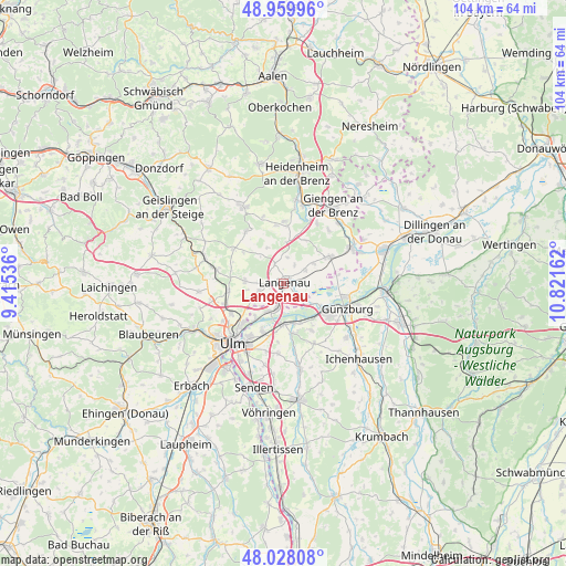
Langenau GPS coordinates[2]
48° 29' 46.176" North, 10° 7' 6.564" East
| Map corner | latitude | longitude |
|---|---|---|
| Upper-left | 48.95996°, | 9.41536° |
| Center: | 48.49616°, | 10.11849° |
| Lower-right: | 48.02808°, | 10.82162° |
| Map W x H: | 103.6×103.6 km | = 64.4×64.4mi |
| max Lat: | 55.01917° ⇑89.2% North |
| Langenau: | 48.49616° |
| min Lat: | ⇓10.8% South 47.40724° |
| min Long | Langenau | max Long |
| 5.92978° | 10.11849° | 14.98853° |
| W 51.9%⇐ | ⇒48.1% E |
Elevation
Elevation of Langenau is 461 m = 1512 ft, and this is 211.9 m = 695 ft above average elevation for this country.
| Max E: |
1256 m = 4121 ft | 16.1% |
| Langenau | 461 m 1512 ft | |
| Avg. | 249.1 m = 817 ft | |
Min E: |
-5 m = -16 ft | 83.9% |
See also: Germany elevation on elevation.city.
Geographical zone
Langenau is located in North temperate zone (between Tropic of Cancer and the Arctic Circle). Distance of this North polar circle is 2008.9 km =1248.3 mi to North.| Distance of | km | miles | from Langenau |
|---|---|---|---|
| North Pole | 4614.8 | 2867.5 | to North |
| Arctic Circle | 2008.9 | 1248.3 | to North |
| Tropic Cancer | 2786.3 | 1731.3 | to South |
| Equator | 5392.3 | 3350.6 | to South |


Nearby cities:
15 places around Langenau: (largest is in red/bold)
• Asselfingen
6.5 km =4 mi,  55°
55°
• Ballendorf
7.1 km =4.4 mi,  334°
334°
• Beimerstetten
10.1 km =6.3 mi,  261°
261°
• Bernstadt
6.8 km =4.2 mi,  273°
273°
• Breitingen
9.6 km =6 mi,  284°
284°
• Börslingen
6.3 km =3.9 mi,  319°
319°
• Holzkirch
9.9 km =6.2 mi,  293°
293°
• Leipheim
9.2 km =5.7 mi,  123°
123°
• Neenstetten
9.2 km =5.7 mi,  307°
307°
• Nerenstetten
3.9 km =2.4 mi,  338°
338°
• Nersingen
7.6 km =4.7 mi,  177°
177°
• Niederstotzingen
9.9 km =6.2 mi, 59°
• Rammingen
4.6 km =2.9 mi, 58°
• Setzingen
4.7 km =2.9 mi,  10°
10°
• Öllingen
4.2 km =2.6 mi,  30°
30°
Sources, notices
• [Note1] Compared only with cities in Germany existing in our database
• [Src1] Map data: © OpenStreetMap contributors (CC-BY-SA)
• [Src2] Other city data from geonames.org with taken over terms of usage.
• [Src3] Geographical zone / Annual Mean Temperature by Robert A. Rohde @ Wikipedia
