Obertiefenbach geodata
Obertiefenbach (Rheinland-Pfalz) is a seat of a fourth-order administrative division; located in Germany in Europe/Berlin (GMT+2) time zone. With population of 382 people, there are 9747 cities with bigger population in this country. Compared to other cities in Germany, 58.1% of cities are located further ↑North; 79.1% of cities are located further →East and 66.1% of cities have lower elevation than Obertiefenbach. Note1
Administrative division(s):
- Level 1: Rheinland-Pfalz
- Level 3: Rhein-Lahn-Kreis
- Level 4: Obertiefenbach


Obertiefenbach GPS coordinates[2]
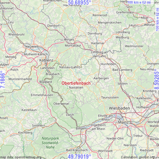
50° 14' 31.164" North, 7° 53' 23.028" East
| Map corner | latitude | longitude |
|---|---|---|
| Upper-left | 50.68955°, | 7.1866° |
| Center: | 50.24199°, | 7.88973° |
| Lower-right: | 49.79019°, | 8.59285° |
| Map W x H: | 100×100 km | = 62.1×62.1mi |
| max Lat: | 55.01917° ⇑58.1% North |
| Obertiefenbach: | 50.24199° |
| min Lat: | ⇓41.9% South 47.40724° |
| min Long | Obertiefenbach | max Long |
| 5.92978° | 7.88973° | 14.98853° |
| W 20.9%⇐ | ⇒79.1% E |
Elevation
Elevation of Obertiefenbach is 329 m = 1079 ft, and this is 79.9 m = 262 ft above average elevation for this country.
| Max E: |
1256 m = 4121 ft | 33.9% |
| Obertiefenbach | 329 m 1079 ft | |
| Avg. | 249.1 m = 817 ft | |
Min E: |
-5 m = -16 ft | 66.1% |
See also: Germany elevation on elevation.city.
Geographical zone
Obertiefenbach is located in North temperate zone (between Tropic of Cancer and the Arctic Circle). Distance of this North polar circle is 1814.8 km =1127.7 mi to North.| Distance of | km | miles | from Obertiefenbach |
|---|---|---|---|
| North Pole | 4420.7 | 2746.9 | to North |
| Arctic Circle | 1814.8 | 1127.7 | to North |
| Tropic Cancer | 2980.5 | 1852 | to South |
| Equator | 5586.4 | 3471.2 | to South |


Nearby cities:
15 places around Obertiefenbach: (largest is in red/bold)
• Bettendorf
1.8 km =1.1 mi,  236°
236°
• Buch
4.9 km =3 mi,  199°
199°
• Ergeshausen
5 km =3.1 mi,  48°
48°
• Herold
4.9 km =3 mi,  37°
37°
• Holzhausen an der Haide
3 km =1.9 mi,  151°
151°
• Hunzel
3.8 km =2.4 mi,  281°
281°
• Lollschied
2.2 km =1.4 mi,  317°
317°
• Miehlen
4.5 km =2.8 mi,  246°
246°
• Mittelfischbach
5.2 km =3.2 mi,  75°
75°
• Nastätten
5.3 km =3.3 mi, 204°
• Niedertiefenbach
1.6 km =1 mi,  19°
19°
• Oberfischbach
4.7 km =2.9 mi, 80°
• Pohl
1.9 km =1.2 mi,  298°
298°
• Rettert
3.7 km =2.3 mi,  108°
108°
• Roth
2.8 km =1.7 mi,  9°
9°
Sources, notices
• [Note1] Compared only with cities in Germany existing in our database
• [Src1] Map data: © OpenStreetMap contributors (CC-BY-SA)
• [Src2] Other city data from geonames.org with taken over terms of usage.
• [Src3] Geographical zone / Annual Mean Temperature by Robert A. Rohde @ Wikipedia
