Rettert geodata
Rettert (Rheinland-Pfalz) is a seat of a fourth-order administrative division; located in Germany in Europe/Berlin (GMT+2) time zone. With population of 496 people, there are 9389 cities with bigger population in this country. Compared to other cities in Germany, 58.4% of cities are located further ↑North; 78.3% of cities are located further →East and 78.7% of cities have lower elevation than Rettert. Note1


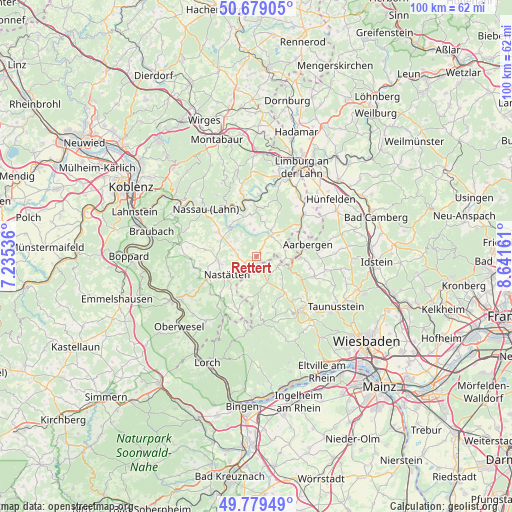
Rettert GPS coordinates[2]
50° 13' 53.004" North, 7° 56' 18.528" East
| Map corner | latitude | longitude |
|---|---|---|
| Upper-left | 50.67905°, | 7.23536° |
| Center: | 50.23139°, | 7.93848° |
| Lower-right: | 49.77949°, | 8.64161° |
| Map W x H: | 100×100 km | = 62.1×62.1mi |
| max Lat: | 55.01917° ⇑58.4% North |
| Rettert: | 50.23139° |
| min Lat: | ⇓41.6% South 47.40724° |
| min Long | Rettert | max Long |
| 5.92978° | 7.93848° | 14.98853° |
| W 21.7%⇐ | ⇒78.3% E |
Elevation
Elevation of Rettert is 424 m = 1391 ft, and this is 174.9 m = 574 ft above average elevation for this country.
| Max E: |
1256 m = 4121 ft | 21.3% |
| Rettert | 424 m 1391 ft | |
| Avg. | 249.1 m = 817 ft | |
Min E: |
-5 m = -16 ft | 78.7% |
See also: Germany elevation on elevation.city.
Geographical zone
Rettert is located in North temperate zone (between Tropic of Cancer and the Arctic Circle). Distance of this North polar circle is 1816 km =1128.4 mi to North.| Distance of | km | miles | from Rettert |
|---|---|---|---|
| North Pole | 4421.9 | 2747.6 | to North |
| Arctic Circle | 1816 | 1128.4 | to North |
| Tropic Cancer | 2979.3 | 1851.3 | to South |
| Equator | 5585.2 | 3470.5 | to South |


Nearby cities:
15 places around Rettert: (largest is in red/bold)
• Berndroth
2.3 km =1.4 mi,  73°
73°
• Bettendorf
5 km =3.1 mi,  272°
272°
• Dörsdorf
5.3 km =3.3 mi, 72°
• Eisighofen
5.6 km =3.5 mi,  87°
87°
• Ergeshausen
4.5 km =2.8 mi,  3°
3°
• Herold
5.1 km =3.2 mi,  354°
354°
• Holzhausen an der Haide
2.5 km =1.6 mi,  235°
235°
• Katzenelnbogen
4.7 km =2.9 mi,  31°
31°
• Klingelbach
5.4 km =3.4 mi,  24°
24°
• Mittelfischbach
3 km =1.9 mi, 33°
• Niedertiefenbach
4 km =2.5 mi,  312°
312°
• Oberfischbach
2.3 km =1.4 mi, 31°
• Obertiefenbach
3.7 km =2.3 mi,  288°
288°
• Pohl
5.5 km =3.4 mi, 292°
• Roth
5 km =3.1 mi,  322°
322°
Sources, notices
• [Note1] Compared only with cities in Germany existing in our database
• [Src1] Map data: © OpenStreetMap contributors (CC-BY-SA)
• [Src2] Other city data from geonames.org with taken over terms of usage.
• [Src3] Geographical zone / Annual Mean Temperature by Robert A. Rohde @ Wikipedia
