Horhausen geodata
Horhausen (Rheinland-Pfalz) is a populated place; located in Germany in Europe/Berlin (GMT+2) time zone. With population of 1,908 people, there are 5192 cities with bigger population in this country. Compared to other cities in Germany, 50.8% of cities are located further ↑North; 86.4% of cities are located further →East and 67.2% of cities have lower elevation than Horhausen. Note1
Administrative division(s):
- Level 1: Rheinland-Pfalz
- Level 3: Landkreis Altenkirchen
- Level 4: Horhausen (Westerwald)


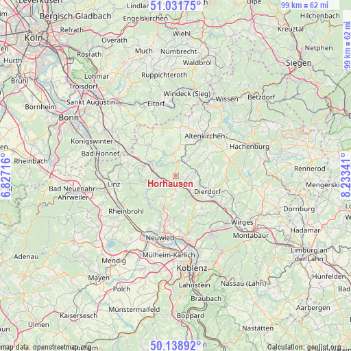
Horhausen GPS coordinates[2]
50° 35' 14.82" North, 7° 31' 49.008" East
| Map corner | latitude | longitude |
|---|---|---|
| Upper-left | 51.03175°, | 6.82716° |
| Center: | 50.58745°, | 7.53028° |
| Lower-right: | 50.13892°, | 8.23341° |
| Map W x H: | 99.3×99.3 km | = 61.7×61.7mi |
| max Lat: | 55.01917° ⇑50.8% North |
| Horhausen: | 50.58745° |
| min Lat: | ⇓49.2% South 47.40724° |
| min Long | Horhausen | max Long |
| 5.92978° | 7.53028° | 14.98853° |
| W 13.6%⇐ | ⇒86.4% E |
Elevation
Elevation of Horhausen is 337 m = 1106 ft, and this is 87.9 m = 288 ft above average elevation for this country.
| Max E: |
1256 m = 4121 ft | 32.8% |
| Horhausen | 337 m 1106 ft | |
| Avg. | 249.1 m = 817 ft | |
Min E: |
-5 m = -16 ft | 67.2% |
See also: Germany elevation on elevation.city.
Geographical zone
Horhausen is located in North temperate zone (between Tropic of Cancer and the Arctic Circle). Distance of this North polar circle is 1776.4 km =1103.8 mi to North.| Distance of | km | miles | from Horhausen |
|---|---|---|---|
| North Pole | 4382.3 | 2723 | to North |
| Arctic Circle | 1776.4 | 1103.8 | to North |
| Tropic Cancer | 3018.9 | 1875.9 | to South |
| Equator | 5624.8 | 3495.1 | to South |


Nearby cities:
15 places around Horhausen: (largest is in red/bold)
• Burglahr
4.1 km =2.5 mi,  325°
325°
• Bürdenbach
2.1 km =1.3 mi, 332°
• Döttesfeld
4.2 km =2.6 mi,  18°
18°
• Eulenberg
4.4 km =2.7 mi,  298°
298°
• Güllesheim
1.2 km =0.7 mi,  353°
353°
• Harschbach
4.9 km =3 mi,  95°
95°
• Krunkel
2.2 km =1.4 mi,  257°
257°
• Linkenbach
1.5 km =0.9 mi,  108°
108°
• Niedersteinebach
2.2 km =1.4 mi,  310°
310°
• Oberhonnefeld-Gierend
3.5 km =2.2 mi,  188°
188°
• Oberlahr
4.1 km =2.5 mi, 346°
• Oberraden
4.2 km =2.6 mi,  177°
177°
• Obersteinebach
3.3 km =2.1 mi, 262°
• Pleckhausen
1.2 km =0.7 mi,  44°
44°
• Willroth
2 km =1.2 mi, 185°
Sources, notices
• [Note1] Compared only with cities in Germany existing in our database
• [Src1] Map data: © OpenStreetMap contributors (CC-BY-SA)
• [Src2] Other city data from geonames.org with taken over terms of usage.
• [Src3] Geographical zone / Annual Mean Temperature by Robert A. Rohde @ Wikipedia
