Pleckhausen geodata
Pleckhausen (Rheinland-Pfalz) is a seat of a fourth-order administrative division; located in Germany in Europe/Berlin (GMT+2) time zone. With population of 785 people, there are 7961 cities with bigger population in this country. Compared to other cities in Germany, 50.6% of cities are located further ↑North; 86.2% of cities are located further →East and 62.7% of cities have lower elevation than Pleckhausen. Note1
Administrative division(s):
- Level 1: Rheinland-Pfalz
- Level 3: Landkreis Altenkirchen
- Level 4: Pleckhausen


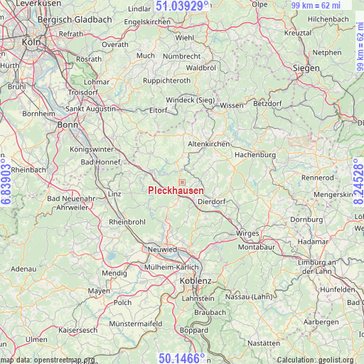
Pleckhausen GPS coordinates[2]
50° 35' 42.216" North, 7° 32' 31.776" East
| Map corner | latitude | longitude |
|---|---|---|
| Upper-left | 51.03929°, | 6.83903° |
| Center: | 50.59506°, | 7.54216° |
| Lower-right: | 50.1466°, | 8.24528° |
| Map W x H: | 99.3×99.3 km | = 61.7×61.7mi |
| max Lat: | 55.01917° ⇑50.6% North |
| Pleckhausen: | 50.59506° |
| min Lat: | ⇓49.4% South 47.40724° |
| min Long | Pleckhausen | max Long |
| 5.92978° | 7.54216° | 14.98853° |
| W 13.8%⇐ | ⇒86.2% E |
Elevation
Elevation of Pleckhausen is 306 m = 1004 ft, and this is 56.9 m = 187 ft above average elevation for this country.
| Max E: |
1256 m = 4121 ft | 37.3% |
| Pleckhausen | 306 m 1004 ft | |
| Avg. | 249.1 m = 817 ft | |
Min E: |
-5 m = -16 ft | 62.7% |
See also: Germany elevation on elevation.city.
Geographical zone
Pleckhausen is located in North temperate zone (between Tropic of Cancer and the Arctic Circle). Distance of this North polar circle is 1775.5 km =1103.2 mi to North.| Distance of | km | miles | from Pleckhausen |
|---|---|---|---|
| North Pole | 4381.4 | 2722.5 | to North |
| Arctic Circle | 1775.5 | 1103.2 | to North |
| Tropic Cancer | 3019.7 | 1876.4 | to South |
| Equator | 5625.6 | 3495.6 | to South |


Nearby cities:
15 places around Pleckhausen: (largest is in red/bold)
• Burglahr
4.1 km =2.5 mi,  308°
308°
• Bürdenbach
2.1 km =1.3 mi,  299°
299°
• Döttesfeld
3.2 km =2 mi,  8°
8°
• Eichen
4.3 km =2.7 mi,  351°
351°
• Güllesheim
1 km =0.6 mi,  287°
287°
• Harschbach
4.3 km =2.7 mi,  107°
107°
• Horhausen
1.2 km =0.7 mi,  224°
224°
• Krunkel
3.2 km =2 mi,  246°
246°
• Linkenbach
1.4 km =0.9 mi,  157°
157°
• Niedersteinebach
2.6 km =1.6 mi,  282°
282°
• Oberhonnefeld-Gierend
4.6 km =2.9 mi,  197°
197°
• Oberlahr
3.6 km =2.2 mi,  330°
330°
• Obersteinebach
4.4 km =2.7 mi, 252°
• Rott
4.6 km =2.9 mi,  337°
337°
• Willroth
3.1 km =1.9 mi, 199°
Sources, notices
• [Note1] Compared only with cities in Germany existing in our database
• [Src1] Map data: © OpenStreetMap contributors (CC-BY-SA)
• [Src2] Other city data from geonames.org with taken over terms of usage.
• [Src3] Geographical zone / Annual Mean Temperature by Robert A. Rohde @ Wikipedia
