Oberboihingen geodata
Oberboihingen (Baden-Württemberg) is a seat of a fourth-order administrative division; located in Germany in Europe/Berlin (GMT+2) time zone. With population of 5,435 people, there are 2653 cities with bigger population in this country. Compared to other cities in Germany, 87.2% of cities are located further ↑North; 59.9% of cities are located further →East and 56.9% of cities have lower elevation than Oberboihingen. Note1
Administrative division(s):
- Level 1: Baden-Württemberg
- Level 2: Regierungsbezirk Stuttgart
- Level 3: Landkreis Esslingen
- Level 4: Oberboihingen


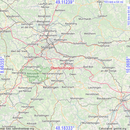
Oberboihingen GPS coordinates[2]
48° 39' 0" North, 9° 22' 0.012" East
| Map corner | latitude | longitude |
|---|---|---|
| Upper-left | 49.11239°, | 8.66355° |
| Center: | 48.65°, | 9.36667° |
| Lower-right: | 48.18333°, | 10.0698° |
| Map W x H: | 103.3×103.3 km | = 64.2×64.2mi |
| max Lat: | 55.01917° ⇑87.2% North |
| Oberboihingen: | 48.65° |
| min Lat: | ⇓12.8% South 47.40724° |
| min Long | Oberboihingen | max Long |
| 5.92978° | 9.36667° | 14.98853° |
| W 40.1%⇐ | ⇒59.9% E |
Elevation
Elevation of Oberboihingen is 271 m = 889 ft, and this is 21.9 m = 72 ft above average elevation for this country.
| Max E: |
1256 m = 4121 ft | 43.1% |
| Oberboihingen | 271 m 889 ft | |
| Avg. | 249.1 m = 817 ft | |
Min E: |
-5 m = -16 ft | 56.9% |
See also: Germany elevation on elevation.city.
Geographical zone
Oberboihingen is located in North temperate zone (between Tropic of Cancer and the Arctic Circle). Distance of this North polar circle is 1991.8 km =1237.6 mi to North.| Distance of | km | miles | from Oberboihingen |
|---|---|---|---|
| North Pole | 4597.7 | 2856.9 | to North |
| Arctic Circle | 1991.8 | 1237.6 | to North |
| Tropic Cancer | 2803.5 | 1742 | to South |
| Equator | 5409.4 | 3361.2 | to South |


Nearby cities:
15 places around Oberboihingen: (largest is in red/bold)
• Deizisau
7.1 km =4.4 mi,  11°
11°
• Denkendorf
6.3 km =3.9 mi,  324°
324°
• Dettingen unter Teck
7.2 km =4.5 mi,  121°
121°
• Frickenhausen
6.3 km =3.9 mi,  184°
184°
• Großbettlingen
7.9 km =4.9 mi,  213°
213°
• Kirchheim unter Teck
6.4 km =4 mi,  93°
93°
• Köngen
3.7 km =2.3 mi,  0°
0°
• Neuhausen auf den Fildern
7.2 km =4.5 mi,  301°
301°
• Notzingen
7 km =4.3 mi,  70°
70°
• Nürtingen
3.3 km =2.1 mi, 213°
• Plochingen
7.8 km =4.8 mi,  29°
29°
• Unterensingen
0.8 km =0.5 mi,  308°
308°
• Wendlingen am Neckar
2.5 km =1.6 mi,  16°
16°
• Wernau
6 km =3.7 mi,  36°
36°
• Wolfschlugen
6.1 km =3.8 mi,  270°
270°
Sources, notices
• [Note1] Compared only with cities in Germany existing in our database
• [Src1] Map data: © OpenStreetMap contributors (CC-BY-SA)
• [Src2] Other city data from geonames.org with taken over terms of usage.
• [Src3] Geographical zone / Annual Mean Temperature by Robert A. Rohde @ Wikipedia
