Nottfeld geodata
Nottfeld (Schleswig-Holstein) is a seat of a fourth-order administrative division; located in Germany in Europe/Berlin (GMT+2) time zone. With population of 157 people, there are 10655 cities with bigger population in this country. Compared to other cities in Germany, 98.6% of cities are located further ↓South; 53.4% of cities are located further →East and 86.6% of cities have higher elevation than Nottfeld. Note1
Administrative division(s):
- Level 1: Schleswig-Holstein
- Level 3: Kreis Schleswig-Flensburg
- Level 4: Nottfeld


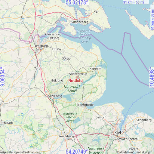
Nottfeld GPS coordinates[2]
54° 37' 0.012" North, 9° 46' 0.012" East
| Map corner | latitude | longitude |
|---|---|---|
| Upper-left | 55.02178°, | 9.06354° |
| Center: | 54.61667°, | 9.76667° |
| Lower-right: | 54.20749°, | 10.4698° |
| Map W x H: | 90.5×90.5 km | = 56.2×56.2mi |
| max Lat: | 55.01917° ⇑1.4% North |
| Nottfeld: | 54.61667° |
| min Lat: | ⇓98.6% South 47.40724° |
| min Long | Nottfeld | max Long |
| 5.92978° | 9.76667° | 14.98853° |
| W 46.6%⇐ | ⇒53.4% E |
Elevation
Elevation of Nottfeld is 31 m = 102 ft, and this is 218.1 m = 716 ft below average elevation for this country.
| Max E: |
1256 m = 4121 ft | 86.6% |
| Avg. | 249.1 m = 817 ft | |
| Nottfeld | 31 m = 102 ft | |
Min E: |
-5 m = -16 ft | 13.4% |
See also: Germany elevation on elevation.city.
Geographical zone
Nottfeld is located in North temperate zone (between Tropic of Cancer and the Arctic Circle). Distance of this North polar circle is 1328.4 km =825.4 mi to North.| Distance of | km | miles | from Nottfeld |
|---|---|---|---|
| North Pole | 3934.3 | 2444.7 | to North |
| Arctic Circle | 1328.4 | 825.4 | to North |
| Tropic Cancer | 3466.9 | 2154.2 | to South |
| Equator | 6072.8 | 3773.5 | to South |


Nearby cities:
15 places around Nottfeld: (largest is in red/bold)
• Boren
3.5 km =2.2 mi,  92°
92°
• Brebel
2.1 km =1.3 mi,  329°
329°
• Böel
4.9 km =3 mi,  319°
319°
• Dollrottfeld
3.7 km =2.3 mi,  60°
60°
• Loit
4.3 km =2.7 mi,  270°
270°
• Mohrkirch
6.4 km =4 mi, 329°
• Norderbrarup
4.1 km =2.5 mi,  1°
1°
• Rabenkirchen-Faulück
5.7 km =3.5 mi,  70°
70°
• Saustrup
5.6 km =3.5 mi, 0°
• Scheggerott
6.4 km =4 mi,  30°
30°
• Steinfeld
2.1 km =1.3 mi,  210°
210°
• Süderbrarup
2.1 km =1.3 mi, 30°
• Twedt
5.7 km =3.5 mi,  250°
250°
• Ulsnis
5.7 km =3.5 mi,  190°
190°
• Wagersrott
6 km =3.7 mi,  21°
21°
Sources, notices
• [Note1] Compared only with cities in Germany existing in our database
• [Src1] Map data: © OpenStreetMap contributors (CC-BY-SA)
• [Src2] Other city data from geonames.org with taken over terms of usage.
• [Src3] Geographical zone / Annual Mean Temperature by Robert A. Rohde @ Wikipedia
