Niersbach geodata
Niersbach (Rheinland-Pfalz) is a seat of a fourth-order administrative division; located in Germany in Europe/Berlin (GMT+2) time zone. With population of 681 people, there are 8411 cities with bigger population in this country. Compared to other cities in Germany, 65.3% of cities are located further ↑North; 96.1% of cities are located further →East and 54.3% of cities have lower elevation than Niersbach. Note1
Administrative division(s):
- Level 1: Rheinland-Pfalz
- Level 3: Landkreis Bernkastel-Wittlich
- Level 4: Niersbach


Niersbach GPS coordinates[2]
49° 56' 24.72" North, 6° 44' 26.736" East
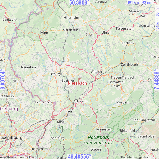
| Map corner | latitude | longitude |
|---|---|---|
| Upper-left | 50.3906°, | 6.03764° |
| Center: | 49.9402°, | 6.74076° |
| Lower-right: | 49.48555°, | 7.44389° |
| Map W x H: | 100.6×100.6 km | = 62.5×62.5mi |
| max Lat: | 55.01917° ⇑65.3% North |
| Niersbach: | 49.9402° |
| min Lat: | ⇓34.7% South 47.40724° |
| min Long | Niersbach | max Long |
| 5.92978° | 6.74076° | 14.98853° |
| W 3.9%⇐ | ⇒96.1% E |
Elevation
Elevation of Niersbach is 254 m = 833 ft, and this is 4.9 m = 16 ft above average elevation for this country.
| Max E: |
1256 m = 4121 ft | 45.7% |
| Niersbach | 254 m 833 ft | |
| Avg. | 249.1 m = 817 ft | |
Min E: |
-5 m = -16 ft | 54.3% |
See also: Germany elevation on elevation.city.
Geographical zone
Niersbach is located in North temperate zone (between Tropic of Cancer and the Arctic Circle). Distance of this North polar circle is 1848.3 km =1148.5 mi to North.| Distance of | km | miles | from Niersbach |
|---|---|---|---|
| North Pole | 4454.2 | 2767.7 | to North |
| Arctic Circle | 1848.3 | 1148.5 | to North |
| Tropic Cancer | 2946.9 | 1831.1 | to South |
| Equator | 5552.8 | 3450.3 | to South |


Nearby cities:
15 places around Niersbach: (largest is in red/bold)
• Arenrath
1.2 km =0.7 mi,  333°
333°
• Beilingen
5.4 km =3.4 mi,  281°
281°
• Bergweiler
6.2 km =3.9 mi,  61°
61°
• Binsfeld
3.4 km =2.1 mi, 329°
• Bruch
3.5 km =2.2 mi, 57°
• Dierscheid
4.9 km =3 mi,  164°
164°
• Dodenburg
4 km =2.5 mi,  130°
130°
• Dreis
5.6 km =3.5 mi,  89°
89°
• Gladbach
2 km =1.2 mi,  112°
112°
• Heckenmünster
5.4 km =3.4 mi,  145°
145°
• Heidweiler
2.7 km =1.7 mi,  165°
165°
• Herforst
3.1 km =1.9 mi,  290°
290°
• Landscheid
5.1 km =3.2 mi,  21°
21°
• Spangdahlem
6.3 km =3.9 mi,  319°
319°
• Zemmer
5.3 km =3.3 mi,  213°
213°
Sources, notices
• [Note1] Compared only with cities in Germany existing in our database
• [Src1] Map data: © OpenStreetMap contributors (CC-BY-SA)
• [Src2] Other city data from geonames.org with taken over terms of usage.
• [Src3] Geographical zone / Annual Mean Temperature by Robert A. Rohde @ Wikipedia
