Gladbach geodata
Gladbach (Rheinland-Pfalz) is a seat of a fourth-order administrative division; located in Germany in Europe/Berlin (GMT+2) time zone. With population of 336 people, there are 9922 cities with bigger population in this country. Compared to other cities in Germany, 65.6% of cities are located further ↑North; 95.9% of cities are located further →East and 55.8% of cities have lower elevation than Gladbach. Note1
Administrative division(s):
- Level 1: Rheinland-Pfalz
- Level 3: Landkreis Bernkastel-Wittlich
- Level 4: Gladbach


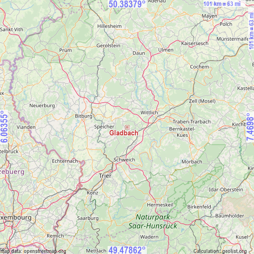
Gladbach GPS coordinates[2]
49° 55' 59.988" North, 6° 46' 0.012" East
| Map corner | latitude | longitude |
|---|---|---|
| Upper-left | 50.38379°, | 6.06355° |
| Center: | 49.93333°, | 6.76667° |
| Lower-right: | 49.47862°, | 7.4698° |
| Map W x H: | 100.6×100.6 km | = 62.5×62.5mi |
| max Lat: | 55.01917° ⇑65.6% North |
| Gladbach: | 49.93333° |
| min Lat: | ⇓34.4% South 47.40724° |
| min Long | Gladbach | max Long |
| 5.92978° | 6.76667° | 14.98853° |
| W 4.1%⇐ | ⇒95.9% E |
Elevation
Elevation of Gladbach is 264 m = 866 ft, and this is 14.9 m = 49 ft above average elevation for this country.
| Max E: |
1256 m = 4121 ft | 44.2% |
| Gladbach | 264 m 866 ft | |
| Avg. | 249.1 m = 817 ft | |
Min E: |
-5 m = -16 ft | 55.8% |
See also: Germany elevation on elevation.city.
Geographical zone
Gladbach is located in North temperate zone (between Tropic of Cancer and the Arctic Circle). Distance of this North polar circle is 1849.1 km =1149 mi to North.| Distance of | km | miles | from Gladbach |
|---|---|---|---|
| North Pole | 4455 | 2768.2 | to North |
| Arctic Circle | 1849.1 | 1149 | to North |
| Tropic Cancer | 2946.1 | 1830.6 | to South |
| Equator | 5552.1 | 3449.9 | to South |


Nearby cities:
15 places around Gladbach: (largest is in red/bold)
• Arenrath
3 km =1.9 mi,  307°
307°
• Bergweiler
5.2 km =3.2 mi,  43°
43°
• Binsfeld
5.2 km =3.2 mi,  316°
316°
• Bruch
2.8 km =1.7 mi,  22°
22°
• Dierscheid
4 km =2.5 mi,  187°
187°
• Dodenburg
2.2 km =1.4 mi,  147°
147°
• Dreis
3.8 km =2.4 mi,  77°
77°
• Heckenmünster
3.9 km =2.4 mi,  162°
162°
• Heidweiler
2.2 km =1.4 mi,  212°
212°
• Herforst
5.1 km =3.2 mi,  291°
291°
• Landscheid
5.6 km =3.5 mi,  0°
0°
• Niersbach
2 km =1.2 mi, 292°
• Salmtal
6 km =3.7 mi,  90°
90°
• Sehlem
6 km =3.7 mi,  127°
127°
• Zemmer
6 km =3.7 mi,  232°
232°
Sources, notices
• [Note1] Compared only with cities in Germany existing in our database
• [Src1] Map data: © OpenStreetMap contributors (CC-BY-SA)
• [Src2] Other city data from geonames.org with taken over terms of usage.
• [Src3] Geographical zone / Annual Mean Temperature by Robert A. Rohde @ Wikipedia
