Dierscheid geodata
Dierscheid (Rheinland-Pfalz) is a seat of a fourth-order administrative division; located in Germany in Europe/Berlin (GMT+2) time zone. With population of 166 people, there are 10611 cities with bigger population in this country. Compared to other cities in Germany, 66.6% of cities are located further ↑North; 95.9% of cities are located further →East and 73.9% of cities have lower elevation than Dierscheid. Note1
Administrative division(s):
- Level 1: Rheinland-Pfalz
- Level 3: Landkreis Bernkastel-Wittlich
- Level 4: Dierscheid


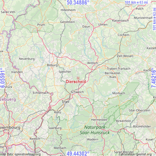
Dierscheid GPS coordinates[2]
49° 53' 53.052" North, 6° 45' 32.508" East
| Map corner | latitude | longitude |
|---|---|---|
| Upper-left | 50.34886°, | 6.05591° |
| Center: | 49.89807°, | 6.75903° |
| Lower-right: | 49.44302°, | 7.46216° |
| Map W x H: | 100.7×100.7 km | = 62.6×62.6mi |
| max Lat: | 55.01917° ⇑66.6% North |
| Dierscheid: | 49.89807° |
| min Lat: | ⇓33.4% South 47.40724° |
| min Long | Dierscheid | max Long |
| 5.92978° | 6.75903° | 14.98853° |
| W 4.1%⇐ | ⇒95.9% E |
Elevation
Elevation of Dierscheid is 389 m = 1276 ft, and this is 139.9 m = 459 ft above average elevation for this country.
| Max E: |
1256 m = 4121 ft | 26.1% |
| Dierscheid | 389 m 1276 ft | |
| Avg. | 249.1 m = 817 ft | |
Min E: |
-5 m = -16 ft | 73.9% |
See also: Germany elevation on elevation.city.
Geographical zone
Dierscheid is located in North temperate zone (between Tropic of Cancer and the Arctic Circle). Distance of this North polar circle is 1853 km =1151.4 mi to North.| Distance of | km | miles | from Dierscheid |
|---|---|---|---|
| North Pole | 4458.9 | 2770.6 | to North |
| Arctic Circle | 1853 | 1151.4 | to North |
| Tropic Cancer | 2942.2 | 1828.2 | to South |
| Equator | 5548.1 | 3447.4 | to South |


Nearby cities:
15 places around Dierscheid: (largest is in red/bold)
• Arenrath
6.1 km =3.8 mi,  342°
342°
• Bekond
6.1 km =3.8 mi,  151°
151°
• Bruch
6.7 km =4.2 mi,  13°
13°
• Dodenburg
2.7 km =1.7 mi,  40°
40°
• Dreis
6.4 km =4 mi, 41°
• Esch
6.5 km =4 mi,  88°
88°
• Föhren
4.3 km =2.7 mi,  174°
174°
• Gladbach
4 km =2.5 mi, 7°
• Heckenmünster
1.8 km =1.1 mi,  82°
82°
• Heidweiler
2.2 km =1.4 mi, 342°
• Hetzerath
4.4 km =2.7 mi,  111°
111°
• Niersbach
4.9 km =3 mi, 344°
• Rivenich
6.7 km =4.2 mi, 111°
• Sehlem
5.3 km =3.3 mi, 87°
• Zemmer
4.2 km =2.6 mi,  272°
272°
Sources, notices
• [Note1] Compared only with cities in Germany existing in our database
• [Src1] Map data: © OpenStreetMap contributors (CC-BY-SA)
• [Src2] Other city data from geonames.org with taken over terms of usage.
• [Src3] Geographical zone / Annual Mean Temperature by Robert A. Rohde @ Wikipedia
