Mötzingen geodata
Mötzingen (Baden-Württemberg) is a seat of a fourth-order administrative division; located in Germany in Europe/Berlin (GMT+2) time zone. With population of 3,542 people, there are 3581 cities with bigger population in this country. Compared to other cities in Germany, 88.7% of cities are located further ↑North; 68.3% of cities are located further →East and 91.2% of cities have lower elevation than Mötzingen. Note1
Administrative division(s):
- Level 1: Baden-Württemberg
- Level 2: Regierungsbezirk Stuttgart
- Level 3: Landkreis Böblingen
- Level 4: Mötzingen


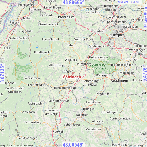
Mötzingen GPS coordinates[2]
48° 31' 59.52" North, 8° 46' 28.092" East
| Map corner | latitude | longitude |
|---|---|---|
| Upper-left | 48.99666°, | 8.07135° |
| Center: | 48.5332°, | 8.77447° |
| Lower-right: | 48.06546°, | 9.4776° |
| Map W x H: | 103.5×103.5 km | = 64.3×64.3mi |
| max Lat: | 55.01917° ⇑88.7% North |
| Mötzingen: | 48.5332° |
| min Lat: | ⇓11.3% South 47.40724° |
| min Long | Mötzingen | max Long |
| 5.92978° | 8.77447° | 14.98853° |
| W 31.7%⇐ | ⇒68.3% E |
Elevation
Elevation of Mötzingen is 531 m = 1742 ft, and this is 281.9 m = 925 ft above average elevation for this country.
| Max E: |
1256 m = 4121 ft | 8.8% |
| Mötzingen | 531 m 1742 ft | |
| Avg. | 249.1 m = 817 ft | |
Min E: |
-5 m = -16 ft | 91.2% |
See also: Germany elevation on elevation.city.
Geographical zone
Mötzingen is located in North temperate zone (between Tropic of Cancer and the Arctic Circle). Distance of this North polar circle is 2004.8 km =1245.7 mi to North.| Distance of | km | miles | from Mötzingen |
|---|---|---|---|
| North Pole | 4610.7 | 2865 | to North |
| Arctic Circle | 2004.8 | 1245.7 | to North |
| Tropic Cancer | 2790.5 | 1733.9 | to South |
| Equator | 5396.4 | 3353.2 | to South |


Nearby cities:
15 places around Mötzingen: (largest is in red/bold)
• Altensteig
13.9 km =8.6 mi,  295°
295°
• Bondorf
4.8 km =3 mi,  106°
106°
• Deckenpfronn
13.6 km =8.5 mi,  15°
15°
• Ebhausen
8.7 km =5.4 mi,  309°
309°
• Egenhausen
12.2 km =7.6 mi,  287°
287°
• Haiterbach
9.7 km =6 mi,  261°
261°
• Herrenberg
9.7 km =6 mi,  44°
44°
• Horb am Neckar
11.6 km =7.2 mi,  211°
211°
• Nagold
4.2 km =2.6 mi, 296°
• Nufringen
13.1 km =8.1 mi, 40°
• Oberjettingen
4.6 km =2.9 mi,  1°
1°
• Rohrdorf
6.6 km =4.1 mi, 304°
• Rottenburg
13.4 km =8.3 mi,  118°
118°
• Unterjettingen
3.3 km =2.1 mi,  12°
12°
• Wildberg
10.3 km =6.4 mi,  347°
347°
Sources, notices
• [Note1] Compared only with cities in Germany existing in our database
• [Src1] Map data: © OpenStreetMap contributors (CC-BY-SA)
• [Src2] Other city data from geonames.org with taken over terms of usage.
• [Src3] Geographical zone / Annual Mean Temperature by Robert A. Rohde @ Wikipedia
