Horb am Neckar geodata
Horb am Neckar (Baden-Württemberg) is a populated place; located in Germany in Europe/Berlin (GMT+2) time zone. With population of 25,960 people, there are 561 cities with bigger population in this country. Compared to other cities in Germany, 89.7% of cities are located further ↑North; 69.2% of cities are located further →East and 74.6% of cities have lower elevation than Horb am Neckar. Note1
Administrative division(s):
- Level 1: Baden-Württemberg
- Level 2: Karlsruhe Region
- Level 3: Landkreis Freudenstadt
- Level 4: Horb am Neckar


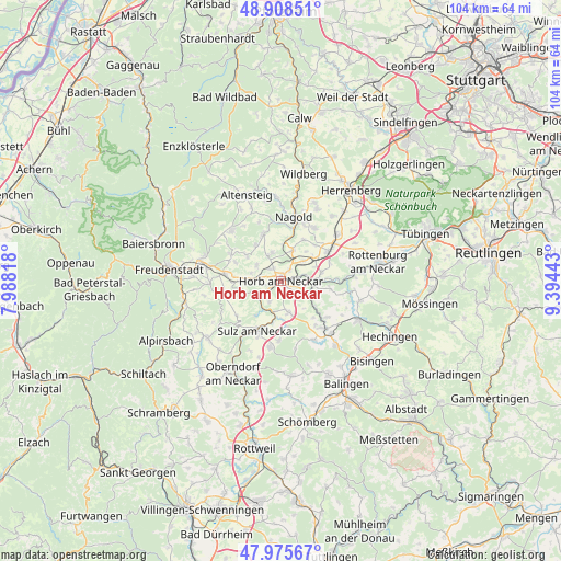
Horb am Neckar GPS coordinates[2]
48° 26' 39.228" North, 8° 41' 28.68" East
| Map corner | latitude | longitude |
|---|---|---|
| Upper-left | 48.90851°, | 7.98818° |
| Center: | 48.44423°, | 8.6913° |
| Lower-right: | 47.97567°, | 9.39443° |
| Map W x H: | 103.7×103.7 km | = 64.4×64.4mi |
| max Lat: | 55.01917° ⇑89.7% North |
| Horb am Neckar: | 48.44423° |
| min Lat: | ⇓10.3% South 47.40724° |
| min Long | Horb am Neckar | max Long |
| 5.92978° | 8.6913° | 14.98853° |
| W 30.8%⇐ | ⇒69.2% E |
Elevation
Elevation of Horb am Neckar is 394 m = 1293 ft, and this is 144.9 m = 475 ft above average elevation for this country.
| Max E: |
1256 m = 4121 ft | 25.4% |
| Horb am Neckar | 394 m 1293 ft | |
| Avg. | 249.1 m = 817 ft | |
Min E: |
-5 m = -16 ft | 74.6% |
See also: Germany elevation on elevation.city.
Geographical zone
Horb am Neckar is located in North temperate zone (between Tropic of Cancer and the Arctic Circle). Distance of this North polar circle is 2014.7 km =1251.9 mi to North.| Distance of | km | miles | from Horb am Neckar |
|---|---|---|---|
| North Pole | 4620.6 | 2871.1 | to North |
| Arctic Circle | 2014.7 | 1251.9 | to North |
| Tropic Cancer | 2780.6 | 1727.8 | to South |
| Equator | 5386.5 | 3347 | to South |


Nearby cities:
15 places around Horb am Neckar: (largest is in red/bold)
• Bondorf
13.7 km =8.5 mi,  51°
51°
• Dornstetten
14.6 km =9.1 mi,  282°
282°
• Egenhausen
14.7 km =9.1 mi,  338°
338°
• Empfingen
5.9 km =3.7 mi,  166°
166°
• Glatten
13.3 km =8.3 mi,  269°
269°
• Haigerloch
12 km =7.5 mi,  136°
136°
• Haiterbach
9.2 km =5.7 mi, 337°
• Mötzingen
11.6 km =7.2 mi,  31°
31°
• Mühlheim am Bach
7.3 km =4.5 mi,  176°
176°
• Nagold
12 km =7.5 mi,  11°
11°
• Pfalzgrafenweiler
13 km =8.1 mi,  314°
314°
• Rohrdorf
13.6 km =8.5 mi,  2°
2°
• Schopfloch
10.4 km =6.5 mi, 276°
• Sulz am Neckar
10.1 km =6.3 mi,  205°
205°
• Vöhringen
12.4 km =7.7 mi,  189°
189°
Sources, notices
• [Note1] Compared only with cities in Germany existing in our database
• [Src1] Map data: © OpenStreetMap contributors (CC-BY-SA)
• [Src2] Other city data from geonames.org with taken over terms of usage.
• [Src3] Geographical zone / Annual Mean Temperature by Robert A. Rohde @ Wikipedia
