Moorhusen geodata
Moorhusen (Schleswig-Holstein) is a seat of a fourth-order administrative division; located in Germany in Europe/Berlin (GMT+2) time zone. In our database, there are 11009 cities with bigger population. Compared to other cities in Germany, 92.2% of cities are located further ↓South; 59.5% of cities are located further →East and 99.9% of cities have higher elevation than Moorhusen. Note1


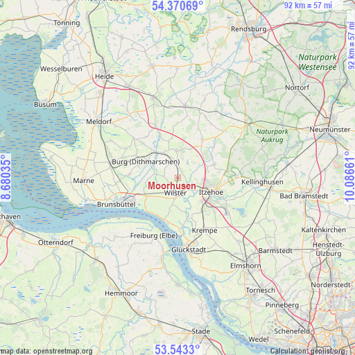
Moorhusen GPS coordinates[2]
53° 57' 32.58" North, 9° 23' 0.528" East
| Map corner | latitude | longitude |
|---|---|---|
| Upper-left | 54.37069°, | 8.68035° |
| Center: | 53.95905°, | 9.38348° |
| Lower-right: | 53.5433°, | 10.08661° |
| Map W x H: | 92×92 km | = 57.2×57.2mi |
| max Lat: | 55.01917° ⇑7.8% North |
| Moorhusen: | 53.95905° |
| min Lat: | ⇓92.2% South 47.40724° |
| min Long | Moorhusen | max Long |
| 5.92978° | 9.38348° | 14.98853° |
| W 40.5%⇐ | ⇒59.5% E |
Elevation
Elevation of Moorhusen is -3 m = -10 ft, and this is 252.1 m = 827 ft below average elevation for this country.
| Max E: |
1256 m = 4121 ft | 99.9% |
| Avg. | 249.1 m = 817 ft | |
| Moorhusen | -3 m = -10 ft | |
Min E: |
-5 m = -16 ft | 0.1% |
See also: Germany elevation on elevation.city.
Geographical zone
Moorhusen is located in North temperate zone (between Tropic of Cancer and the Arctic Circle). Distance of this North polar circle is 1401.5 km =870.9 mi to North.| Distance of | km | miles | from Moorhusen |
|---|---|---|---|
| North Pole | 4007.4 | 2490.1 | to North |
| Arctic Circle | 1401.5 | 870.9 | to North |
| Tropic Cancer | 3393.8 | 2108.8 | to South |
| Equator | 5999.7 | 3728 | to South |


Nearby cities:
15 places around Moorhusen: (largest is in red/bold)
• Bekdorf
3.4 km =2.1 mi,  130°
130°
• Bekmünde
5.6 km =3.5 mi, 132°
• Dammfleth
5.6 km =3.5 mi,  186°
186°
• Huje
3.9 km =2.4 mi,  58°
58°
• Kaaks
6.6 km =4.1 mi, 58°
• Kleve
1.4 km =0.9 mi,  51°
51°
• Krummendiek
2.6 km =1.6 mi,  122°
122°
• Landrecht
3.1 km =1.9 mi,  201°
201°
• Mehlbek
6.1 km =3.8 mi,  33°
33°
• Nutteln
3.2 km =2 mi,  3°
3°
• Oldendorf
5 km =3.1 mi,  97°
97°
• Stördorf
5.6 km =3.5 mi,  150°
150°
• Vaale
4.6 km =2.9 mi,  359°
359°
• Vaalermoor
4.1 km =2.5 mi,  314°
314°
• Wilster
4.1 km =2.5 mi, 188°
Sources, notices
• [Note1] Compared only with cities in Germany existing in our database
• [Src1] Map data: © OpenStreetMap contributors (CC-BY-SA)
• [Src2] Other city data from geonames.org with taken over terms of usage.
• [Src3] Geographical zone / Annual Mean Temperature by Robert A. Rohde @ Wikipedia
