Loose geodata
Loose (Schleswig-Holstein) is a seat of a fourth-order administrative division; located in Germany in Europe/Berlin (GMT+2) time zone. With population of 841 people, there are 7739 cities with bigger population in this country. Compared to other cities in Germany, 98.1% of cities are located further ↓South; 51.7% of cities are located further →East and 89.7% of cities have higher elevation than Loose. Note1
Administrative division(s):
- Level 1: Schleswig-Holstein
- Level 3: Kreis Rendsburg-Eckernförde
- Level 4: Loose


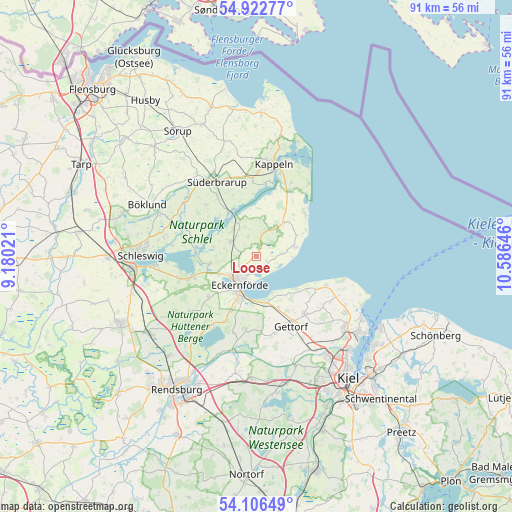
Loose GPS coordinates[2]
54° 31' 0.012" North, 9° 52' 59.988" East
| Map corner | latitude | longitude |
|---|---|---|
| Upper-left | 54.92277°, | 9.18021° |
| Center: | 54.51667°, | 9.88333° |
| Lower-right: | 54.10649°, | 10.58646° |
| Map W x H: | 90.8×90.8 km | = 56.4×56.4mi |
| max Lat: | 55.01917° ⇑1.9% North |
| Loose: | 54.51667° |
| min Lat: | ⇓98.1% South 47.40724° |
| min Long | Loose | max Long |
| 5.92978° | 9.88333° | 14.98853° |
| W 48.3%⇐ | ⇒51.7% E |
Elevation
Elevation of Loose is 22 m = 72 ft, and this is 227.1 m = 745 ft below average elevation for this country.
| Max E: |
1256 m = 4121 ft | 89.7% |
| Avg. | 249.1 m = 817 ft | |
| Loose | 22 m = 72 ft | |
Min E: |
-5 m = -16 ft | 10.3% |
See also: Germany elevation on elevation.city.
Geographical zone
Loose is located in North temperate zone (between Tropic of Cancer and the Arctic Circle). Distance of this North polar circle is 1339.5 km =832.3 mi to North.| Distance of | km | miles | from Loose |
|---|---|---|---|
| North Pole | 3945.4 | 2451.6 | to North |
| Arctic Circle | 1339.5 | 832.3 | to North |
| Tropic Cancer | 3455.8 | 2147.3 | to South |
| Equator | 6061.7 | 3766.6 | to South |


Nearby cities:
15 places around Loose: (largest is in red/bold)
• Altenhof
9.3 km =5.8 mi,  186°
186°
• Barkelsby
3.7 km =2.3 mi,  240°
240°
• Brodersby
10.9 km =6.8 mi,  279°
279°
• Eckernförde
6.1 km =3.8 mi,  208°
208°
• Gammelby
5.7 km =3.5 mi,  250°
250°
• Goosefeld
10.2 km =6.3 mi,  204°
204°
• Holzdorf
3.7 km =2.3 mi,  0°
0°
• Kosel
8.3 km =5.2 mi,  261°
261°
• Neudorf-Bornstein
10.2 km =6.3 mi,  155°
155°
• Noer
9.4 km =5.8 mi,  126°
126°
• Rieseby
5.1 km =3.2 mi,  302°
302°
• Thumby
7.7 km =4.8 mi,  16°
16°
• Ulsnis
10.2 km =6.3 mi, 302°
• Waabs
6.7 km =4.2 mi,  73°
73°
• Windeby
7 km =4.3 mi,  217°
217°
Sources, notices
• [Note1] Compared only with cities in Germany existing in our database
• [Src1] Map data: © OpenStreetMap contributors (CC-BY-SA)
• [Src2] Other city data from geonames.org with taken over terms of usage.
• [Src3] Geographical zone / Annual Mean Temperature by Robert A. Rohde @ Wikipedia
