Brodersby geodata
Brodersby (Schleswig-Holstein) is a seat of a fourth-order administrative division; located in Germany in Europe/Berlin (GMT+2) time zone. With population of 727 people, there are 8206 cities with bigger population in this country. Compared to other cities in Germany, 98.2% of cities are located further ↓South; 54.2% of cities are located further →East and 95.6% of cities have higher elevation than Brodersby. Note1
Administrative division(s):
- Level 1: Schleswig-Holstein
- Level 3: Kreis Schleswig-Flensburg
- Level 4: Brodersby-Goltoft


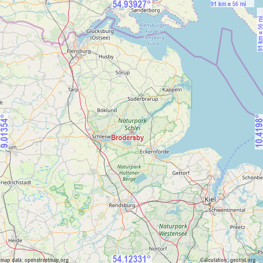
Brodersby GPS coordinates[2]
54° 31' 59.988" North, 9° 43' 0.012" East
| Map corner | latitude | longitude |
|---|---|---|
| Upper-left | 54.93927°, | 9.01354° |
| Center: | 54.53333°, | 9.71667° |
| Lower-right: | 54.12331°, | 10.4198° |
| Map W x H: | 90.7×90.7 km | = 56.4×56.4mi |
| max Lat: | 55.01917° ⇑1.8% North |
| Brodersby: | 54.53333° |
| min Lat: | ⇓98.2% South 47.40724° |
| min Long | Brodersby | max Long |
| 5.92978° | 9.71667° | 14.98853° |
| W 45.8%⇐ | ⇒54.2% E |
Elevation
Elevation of Brodersby is 7 m = 23 ft, and this is 242.1 m = 794 ft below average elevation for this country.
| Max E: |
1256 m = 4121 ft | 95.6% |
| Avg. | 249.1 m = 817 ft | |
| Brodersby | 7 m = 23 ft | |
Min E: |
-5 m = -16 ft | 4.4% |
See also: Germany elevation on elevation.city.
Geographical zone
Brodersby is located in North temperate zone (between Tropic of Cancer and the Arctic Circle). Distance of this North polar circle is 1337.6 km =831.1 mi to North.| Distance of | km | miles | from Brodersby |
|---|---|---|---|
| North Pole | 3943.5 | 2450.4 | to North |
| Arctic Circle | 1337.6 | 831.1 | to North |
| Tropic Cancer | 3457.6 | 2148.5 | to South |
| Equator | 6063.5 | 3767.7 | to South |


Nearby cities:
15 places around Brodersby: (largest is in red/bold)
• Barkelsby
8.4 km =5.2 mi,  116°
116°
• Borgwedel
4.9 km =3 mi,  221°
221°
• Fleckeby
5.7 km =3.5 mi,  190°
190°
• Gammelby
6.5 km =4 mi, 124°
• Goltoft
1.9 km =1.2 mi,  0°
0°
• Güby
6.4 km =4 mi,  210°
210°
• Hummelfeld
7.4 km =4.6 mi,  180°
180°
• Kosel
4 km =2.5 mi,  139°
139°
• Rieseby
6.5 km =4 mi,  82°
82°
• Schaalby
5.7 km =3.5 mi,  289°
289°
• Steinfeld
7.7 km =4.8 mi,  16°
16°
• Taarstedt
4.3 km =2.7 mi,  329°
329°
• Tolk
7.2 km =4.5 mi,  315°
315°
• Twedt
7.7 km =4.8 mi,  343°
343°
• Ulsnis
4.3 km =2.7 mi,  30°
30°
Sources, notices
• [Note1] Compared only with cities in Germany existing in our database
• [Src1] Map data: © OpenStreetMap contributors (CC-BY-SA)
• [Src2] Other city data from geonames.org with taken over terms of usage.
• [Src3] Geographical zone / Annual Mean Temperature by Robert A. Rohde @ Wikipedia
