Liessow geodata
Liessow (Mecklenburg-Vorpommern) is a populated place; located in Germany in Europe/Berlin (GMT+2) time zone. With population of 582 people, there are 8909 cities with bigger population in this country. Compared to other cities in Germany, 91.1% of cities are located further ↓South; 86.2% of cities are located further ←West and 90.5% of cities have higher elevation than Liessow. Note1
Administrative division(s):
- Level 1: Mecklenburg-Vorpommern
- Level 3: Landkreis Rostock
- Level 4: Laage


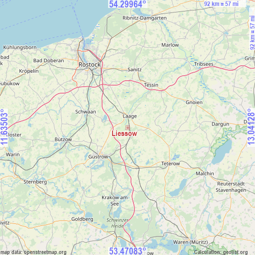
Liessow GPS coordinates[2]
53° 53' 14.244" North, 12° 20' 17.34" East
| Map corner | latitude | longitude |
|---|---|---|
| Upper-left | 54.29964°, | 11.63503° |
| Center: | 53.88729°, | 12.33815° |
| Lower-right: | 53.47083°, | 13.04128° |
| Map W x H: | 92.2×92.2 km | = 57.3×57.3mi |
| max Lat: | 55.01917° ⇑8.9% North |
| Liessow: | 53.88729° |
| min Lat: | ⇓91.1% South 47.40724° |
| min Long | Liessow | max Long |
| 5.92978° | 12.33815° | 14.98853° |
| W 86.2%⇐ | ⇒13.8% E |
Elevation
Elevation of Liessow is 20 m = 66 ft, and this is 229.1 m = 752 ft below average elevation for this country.
| Max E: |
1256 m = 4121 ft | 90.5% |
| Avg. | 249.1 m = 817 ft | |
| Liessow | 20 m = 66 ft | |
Min E: |
-5 m = -16 ft | 9.5% |
See also: Germany elevation on elevation.city.
Geographical zone
Liessow is located in North temperate zone (between Tropic of Cancer and the Arctic Circle). Distance of this North polar circle is 1409.5 km =875.8 mi to North.| Distance of | km | miles | from Liessow |
|---|---|---|---|
| North Pole | 4015.4 | 2495.1 | to North |
| Arctic Circle | 1409.5 | 875.8 | to North |
| Tropic Cancer | 3385.8 | 2103.8 | to South |
| Equator | 5991.7 | 3723.1 | to South |


Nearby cities:
15 places around Liessow: (largest is in red/bold)
• Cammin
11.5 km =7.1 mi,  6°
6°
• Diekhof
2.8 km =1.7 mi,  145°
145°
• Dolgen
9 km =5.6 mi,  325°
325°
• Groß Wüstenfelde
14.1 km =8.8 mi,  96°
96°
• Güstrow
14.7 km =9.1 mi,  227°
227°
• Hohen Sprenz
9.8 km =6.1 mi,  285°
285°
• Laage
4.3 km =2.7 mi, 7°
• Lüssow
13.9 km =8.6 mi,  247°
247°
• Mistorf
12.7 km =7.9 mi,  268°
268°
• Plaaz
4.9 km =3 mi,  176°
176°
• Prisannewitz
13.4 km =8.3 mi,  324°
324°
• Sarmstorf
9.9 km =6.2 mi,  239°
239°
• Wardow
6.6 km =4.1 mi,  43°
43°
• Wattmannshagen
13.2 km =8.2 mi,  159°
159°
• Wiendorf
13.9 km =8.6 mi,  298°
298°
Sources, notices
• [Note1] Compared only with cities in Germany existing in our database
• [Src1] Map data: © OpenStreetMap contributors (CC-BY-SA)
• [Src2] Other city data from geonames.org with taken over terms of usage.
• [Src3] Geographical zone / Annual Mean Temperature by Robert A. Rohde @ Wikipedia
