Leiwen geodata
Leiwen (Rheinland-Pfalz) is a seat of a fourth-order administrative division; located in Germany in Europe/Berlin (GMT+2) time zone. With population of 1,460 people, there are 5958 cities with bigger population in this country. Compared to other cities in Germany, 68.6% of cities are located further ↑North; 94.8% of cities are located further →East and 61.6% of cities have higher elevation than Leiwen. Note1
Administrative division(s):
- Level 1: Rheinland-Pfalz
- Level 3: Landkreis Trier-Saarburg
- Level 4: Leiwen


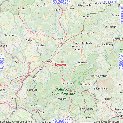
Leiwen GPS coordinates[2]
49° 49' 0.012" North, 6° 52' 59.988" East
| Map corner | latitude | longitude |
|---|---|---|
| Upper-left | 50.26823°, | 6.18021° |
| Center: | 49.81667°, | 6.88333° |
| Lower-right: | 49.36086°, | 7.58646° |
| Map W x H: | 100.9×100.9 km | = 62.7×62.7mi |
| max Lat: | 55.01917° ⇑68.6% North |
| Leiwen: | 49.81667° |
| min Lat: | ⇓31.4% South 47.40724° |
| min Long | Leiwen | max Long |
| 5.92978° | 6.88333° | 14.98853° |
| W 5.2%⇐ | ⇒94.8% E |
Elevation
Elevation of Leiwen is 141 m = 463 ft, and this is 108.1 m = 355 ft below average elevation for this country.
| Max E: |
1256 m = 4121 ft | 61.6% |
| Avg. | 249.1 m = 817 ft | |
| Leiwen | 141 m = 463 ft | |
Min E: |
-5 m = -16 ft | 38.4% |
See also: Germany elevation on elevation.city.
Geographical zone
Leiwen is located in North temperate zone (between Tropic of Cancer and the Arctic Circle). Distance of this North polar circle is 1862.1 km =1157.1 mi to North.| Distance of | km | miles | from Leiwen |
|---|---|---|---|
| North Pole | 4468 | 2776.3 | to North |
| Arctic Circle | 1862.1 | 1157.1 | to North |
| Tropic Cancer | 2933.2 | 1822.6 | to South |
| Equator | 5539.1 | 3441.8 | to South |


Nearby cities:
15 places around Leiwen: (largest is in red/bold)
• Breit
4.8 km =3 mi,  160°
160°
• Büdlich
3.9 km =2.4 mi, 162°
• Detzem
2.4 km =1.5 mi,  270°
270°
• Ensch
3.8 km =2.4 mi,  287°
287°
• Heidenburg
3 km =1.9 mi,  127°
127°
• Klüsserath
3.9 km =2.4 mi,  323°
323°
• Köwerich
1.9 km =1.2 mi,  0°
0°
• Mehring
4 km =2.5 mi,  242°
242°
• Minheim
6.6 km =4.1 mi,  35°
35°
• Neumagen-Dhron
4.4 km =2.7 mi,  13°
13°
• Pölich
3 km =1.9 mi,  232°
232°
• Schleich
3.6 km =2.2 mi, 270°
• Schönberg
6.1 km =3.8 mi, 156°
• Thörnich
3.8 km =2.4 mi,  301°
301°
• Trittenheim
1.5 km =0.9 mi,  52°
52°
Sources, notices
• [Note1] Compared only with cities in Germany existing in our database
• [Src1] Map data: © OpenStreetMap contributors (CC-BY-SA)
• [Src2] Other city data from geonames.org with taken over terms of usage.
• [Src3] Geographical zone / Annual Mean Temperature by Robert A. Rohde @ Wikipedia
