Lauterecken geodata
Lauterecken (Rheinland-Pfalz) is a populated place; located in Germany in Europe/Berlin (GMT+2) time zone. With population of 2,292 people, there are 4685 cities with bigger population in this country. Compared to other cities in Germany, 72.6% of cities are located further ↑North; 85.2% of cities are located further →East and 57.5% of cities have higher elevation than Lauterecken. Note1


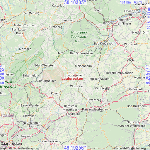
Lauterecken GPS coordinates[2]
49° 38' 59.748" North, 7° 35' 33.54" East
| Map corner | latitude | longitude |
|---|---|---|
| Upper-left | 50.10305°, | 6.88952° |
| Center: | 49.64993°, | 7.59265° |
| Lower-right: | 49.19256°, | 8.29577° |
| Map W x H: | 101.2×101.2 km | = 62.9×62.9mi |
| max Lat: | 55.01917° ⇑72.6% North |
| Lauterecken: | 49.64993° |
| min Lat: | ⇓27.4% South 47.40724° |
| min Long | Lauterecken | max Long |
| 5.92978° | 7.59265° | 14.98853° |
| W 14.8%⇐ | ⇒85.2% E |
Elevation
Elevation of Lauterecken is 171 m = 561 ft, and this is 78.1 m = 256 ft below average elevation for this country.
| Max E: |
1256 m = 4121 ft | 57.5% |
| Avg. | 249.1 m = 817 ft | |
| Lauterecken | 171 m = 561 ft | |
Min E: |
-5 m = -16 ft | 42.5% |
See also: Germany elevation on elevation.city.
Geographical zone
Lauterecken is located in North temperate zone (between Tropic of Cancer and the Arctic Circle). Distance of this North polar circle is 1880.6 km =1168.6 mi to North.| Distance of | km | miles | from Lauterecken |
|---|---|---|---|
| North Pole | 4486.5 | 2787.8 | to North |
| Arctic Circle | 1880.6 | 1168.6 | to North |
| Tropic Cancer | 2914.6 | 1811 | to South |
| Equator | 5520.6 | 3430.3 | to South |


Nearby cities:
15 places around Lauterecken: (largest is in red/bold)
• Adenbach
4.5 km =2.8 mi,  65°
65°
• Buborn
4 km =2.5 mi,  251°
251°
• Cronenberg
1.7 km =1.1 mi,  89°
89°
• Einöllen
4.7 km =2.9 mi,  141°
141°
• Ginsweiler
4.1 km =2.5 mi, 89°
• Grumbach
1.9 km =1.2 mi,  270°
270°
• Hausweiler
1.9 km =1.2 mi, 270°
• Heinzenhausen
1.9 km =1.2 mi,  164°
164°
• Herren-Sulzbach
4.3 km =2.7 mi, 270°
• Hohenöllen
4.7 km =2.9 mi, 141°
• Kappeln
4.2 km =2.6 mi,  333°
333°
• Lohnweiler
1.9 km =1.2 mi, 164°
• Löllbach
3.8 km =2.4 mi,  349°
349°
• Medard
2.5 km =1.6 mi,  42°
42°
• Wiesweiler
2.6 km =1.6 mi,  225°
225°
Sources, notices
• [Note1] Compared only with cities in Germany existing in our database
• [Src1] Map data: © OpenStreetMap contributors (CC-BY-SA)
• [Src2] Other city data from geonames.org with taken over terms of usage.
• [Src3] Geographical zone / Annual Mean Temperature by Robert A. Rohde @ Wikipedia
