Cronenberg geodata
Cronenberg (Rheinland-Pfalz) is a seat of a fourth-order administrative division; located in Germany in Europe/Berlin (GMT+2) time zone. With population of 172 people, there are 10585 cities with bigger population in this country. Compared to other cities in Germany, 72.6% of cities are located further ↑North; 84.8% of cities are located further →East and 52.6% of cities have higher elevation than Cronenberg. Note1


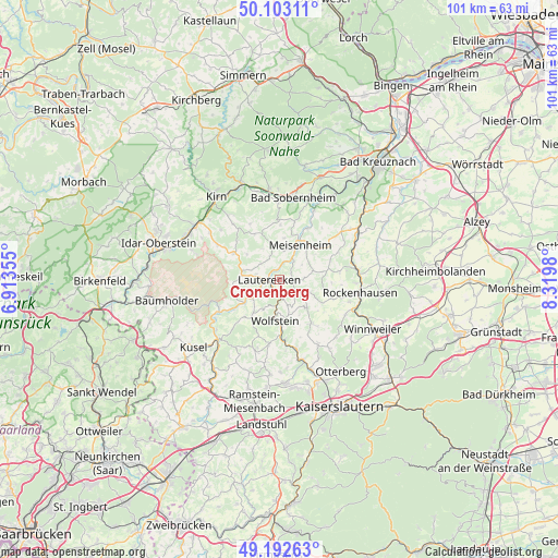
Cronenberg GPS coordinates[2]
49° 39' 0" North, 7° 37' 0.012" East
| Map corner | latitude | longitude |
|---|---|---|
| Upper-left | 50.10311°, | 6.91355° |
| Center: | 49.65°, | 7.61667° |
| Lower-right: | 49.19263°, | 8.3198° |
| Map W x H: | 101.2×101.2 km | = 62.9×62.9mi |
| max Lat: | 55.01917° ⇑72.6% North |
| Cronenberg: | 49.65° |
| min Lat: | ⇓27.4% South 47.40724° |
| min Long | Cronenberg | max Long |
| 5.92978° | 7.61667° | 14.98853° |
| W 15.2%⇐ | ⇒84.8% E |
Elevation
Elevation of Cronenberg is 207 m = 679 ft, and this is 42.1 m = 138 ft below average elevation for this country.
| Max E: |
1256 m = 4121 ft | 52.6% |
| Avg. | 249.1 m = 817 ft | |
| Cronenberg | 207 m = 679 ft | |
Min E: |
-5 m = -16 ft | 47.4% |
See also: Germany elevation on elevation.city.
Geographical zone
Cronenberg is located in North temperate zone (between Tropic of Cancer and the Arctic Circle). Distance of this North polar circle is 1880.6 km =1168.6 mi to North.| Distance of | km | miles | from Cronenberg |
|---|---|---|---|
| North Pole | 4486.5 | 2787.8 | to North |
| Arctic Circle | 1880.6 | 1168.6 | to North |
| Tropic Cancer | 2914.6 | 1811 | to South |
| Equator | 5520.6 | 3430.3 | to South |


Nearby cities:
15 places around Cronenberg: (largest is in red/bold)
• Adenbach
3 km =1.9 mi,  52°
52°
• Becherbach
4.8 km =3 mi,  90°
90°
• Einöllen
3.9 km =2.4 mi,  162°
162°
• Ginsweiler
2.4 km =1.5 mi, 90°
• Grumbach
3.6 km =2.2 mi,  270°
270°
• Hausweiler
3.6 km =2.2 mi, 270°
• Heinzenhausen
2.2 km =1.4 mi,  212°
212°
• Hohenöllen
3.9 km =2.4 mi, 162°
• Lauterecken
1.7 km =1.1 mi, 269°
• Lohnweiler
2.2 km =1.4 mi, 212°
• Löllbach
4.4 km =2.7 mi,  327°
327°
• Medard
1.9 km =1.2 mi,  0°
0°
• Odenbach
4.4 km =2.7 mi,  32°
32°
• Reipoltskirchen
4 km =2.5 mi,  117°
117°
• Wiesweiler
4 km =2.5 mi,  242°
242°
Sources, notices
• [Note1] Compared only with cities in Germany existing in our database
• [Src1] Map data: © OpenStreetMap contributors (CC-BY-SA)
• [Src2] Other city data from geonames.org with taken over terms of usage.
• [Src3] Geographical zone / Annual Mean Temperature by Robert A. Rohde @ Wikipedia
