Ladelund geodata
Ladelund (Schleswig-Holstein) is a seat of a fourth-order administrative division; located in Germany in Europe/Berlin (GMT+2) time zone. With population of 1,500 people, there are 5880 cities with bigger population in this country. Compared to other cities in Germany, 99.8% of cities are located further ↓South; 65.1% of cities are located further →East and 90.9% of cities have higher elevation than Ladelund. Note1
Administrative division(s):
- Level 1: Schleswig-Holstein
- Level 3: Kreis Nordfriesland
- Level 4: Ladelund


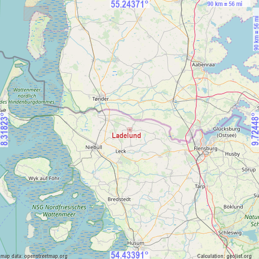
Ladelund GPS coordinates[2]
54° 50' 27.024" North, 9° 1' 16.86" East
| Map corner | latitude | longitude |
|---|---|---|
| Upper-left | 55.24371°, | 8.31823° |
| Center: | 54.84084°, | 9.02135° |
| Lower-right: | 54.43391°, | 9.72448° |
| Map W x H: | 90×90 km | = 55.9×55.9mi |
| max Lat: | 55.01917° ⇑0.2% North |
| Ladelund: | 54.84084° |
| min Lat: | ⇓99.8% South 47.40724° |
| min Long | Ladelund | max Long |
| 5.92978° | 9.02135° | 14.98853° |
| W 34.9%⇐ | ⇒65.1% E |
Elevation
Elevation of Ladelund is 19 m = 62 ft, and this is 230.1 m = 755 ft below average elevation for this country.
| Max E: |
1256 m = 4121 ft | 90.9% |
| Avg. | 249.1 m = 817 ft | |
| Ladelund | 19 m = 62 ft | |
Min E: |
-5 m = -16 ft | 9.1% |
See also: Germany elevation on elevation.city.
Geographical zone
Ladelund is located in North temperate zone (between Tropic of Cancer and the Arctic Circle). Distance of this North polar circle is 1303.4 km =809.9 mi to North.| Distance of | km | miles | from Ladelund |
|---|---|---|---|
| North Pole | 3909.3 | 2429.1 | to North |
| Arctic Circle | 1303.4 | 809.9 | to North |
| Tropic Cancer | 3491.8 | 2169.7 | to South |
| Equator | 6097.7 | 3788.9 | to South |


Nearby cities:
15 places around Ladelund: (largest is in red/bold)
• Achtrup
5.6 km =3.5 mi,  175°
175°
• Braderup
8.4 km =5.2 mi,  265°
265°
• Bramstedtlund
3.1 km =1.9 mi,  70°
70°
• Ellhöft
6.6 km =4.1 mi,  315°
315°
• Holm
9.9 km =6.2 mi, 265°
• Holt
8.7 km =5.4 mi,  108°
108°
• Karlum
3.6 km =2.2 mi,  256°
256°
• Klixbüll
9.1 km =5.7 mi,  242°
242°
• Leck
8.6 km =5.3 mi,  196°
196°
• Lexgaard
5.7 km =3.5 mi, 261°
• Sprakebüll
7.5 km =4.7 mi,  148°
148°
• Süderlügum
8 km =5 mi,  297°
297°
• Tinningstedt
6.2 km =3.9 mi, 244°
• Weesby
8.3 km =5.2 mi,  95°
95°
• Westre
2.6 km =1.6 mi,  292°
292°
Sources, notices
• [Note1] Compared only with cities in Germany existing in our database
• [Src1] Map data: © OpenStreetMap contributors (CC-BY-SA)
• [Src2] Other city data from geonames.org with taken over terms of usage.
• [Src3] Geographical zone / Annual Mean Temperature by Robert A. Rohde @ Wikipedia
