Ellhöft geodata
Ellhöft (Schleswig-Holstein) is a seat of a fourth-order administrative division; located in Germany in Europe/Berlin (GMT+2) time zone. With population of 141 people, there are 10719 cities with bigger population in this country. Compared to other cities in Germany, 99.9% of cities are located further ↓South; 66.1% of cities are located further →East and 97% of cities have higher elevation than Ellhöft. Note1
Administrative division(s):
- Level 1: Schleswig-Holstein
- Level 3: Kreis Nordfriesland
- Level 4: Ellhöft


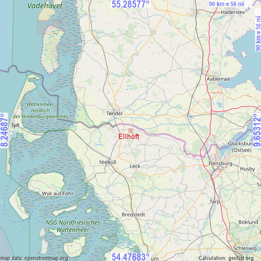
Ellhöft GPS coordinates[2]
54° 52' 59.988" North, 8° 57' 0" East
| Map corner | latitude | longitude |
|---|---|---|
| Upper-left | 55.28577°, | 8.24687° |
| Center: | 54.88333°, | 8.95° |
| Lower-right: | 54.47683°, | 9.65312° |
| Map W x H: | 89.9×89.9 km | = 55.9×55.9mi |
| max Lat: | 55.01917° ⇑0.1% North |
| Ellhöft: | 54.88333° |
| min Lat: | ⇓99.9% South 47.40724° |
| min Long | Ellhöft | max Long |
| 5.92978° | 8.95° | 14.98853° |
| W 33.9%⇐ | ⇒66.1% E |
Elevation
Elevation of Ellhöft is 4 m = 13 ft, and this is 245.1 m = 804 ft below average elevation for this country.
| Max E: |
1256 m = 4121 ft | 97% |
| Avg. | 249.1 m = 817 ft | |
| Ellhöft | 4 m = 13 ft | |
Min E: |
-5 m = -16 ft | 3% |
See also: Germany elevation on elevation.city.
Geographical zone
Ellhöft is located in North temperate zone (between Tropic of Cancer and the Arctic Circle). Distance of this North polar circle is 1298.7 km =807 mi to North.| Distance of | km | miles | from Ellhöft |
|---|---|---|---|
| North Pole | 3904.6 | 2426.2 | to North |
| Arctic Circle | 1298.7 | 807 | to North |
| Tropic Cancer | 3496.5 | 2172.6 | to South |
| Equator | 6102.5 | 3791.9 | to South |


Nearby cities:
15 places around Ellhöft: (largest is in red/bold)
• Achtrup
11.5 km =7.1 mi,  154°
154°
• Aventoft
8.7 km =5.4 mi,  282°
282°
• Bosbüll
9.1 km =5.7 mi,  215°
215°
• Braderup
6.6 km =4.1 mi, 215°
• Bramstedtlund
8.3 km =5.2 mi,  116°
116°
• Holm
7.7 km =4.8 mi, 223°
• Humptrup
5.6 km =3.5 mi,  250°
250°
• Karlum
5.7 km =3.5 mi,  169°
169°
• Klixbüll
9.5 km =5.9 mi,  201°
201°
• Ladelund
6.6 km =4.1 mi,  135°
135°
• Lexgaard
5.7 km =3.5 mi,  190°
190°
• Süderlügum
2.7 km =1.7 mi, 247°
• Tinningstedt
7.5 km =4.7 mi, 188°
• Uphusum
7.4 km =4.6 mi,  239°
239°
• Westre
4.3 km =2.7 mi, 150°
Sources, notices
• [Note1] Compared only with cities in Germany existing in our database
• [Src1] Map data: © OpenStreetMap contributors (CC-BY-SA)
• [Src2] Other city data from geonames.org with taken over terms of usage.
• [Src3] Geographical zone / Annual Mean Temperature by Robert A. Rohde @ Wikipedia
