Krokau geodata
Krokau (Schleswig-Holstein) is a seat of a fourth-order administrative division; located in Germany in Europe/Berlin (GMT+2) time zone. With population of 485 people, there are 9435 cities with bigger population in this country. Compared to other cities in Germany, 97.4% of cities are located further ↓South; 56.3% of cities are located further ←West and 96.2% of cities have higher elevation than Krokau. Note1


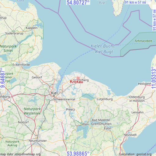
Krokau GPS coordinates[2]
54° 24' 0" North, 10° 21' 0" East
| Map corner | latitude | longitude |
|---|---|---|
| Upper-left | 54.80727°, | 9.64687° |
| Center: | 54.4°, | 10.35° |
| Lower-right: | 53.98865°, | 11.05313° |
| Map W x H: | 91×91 km | = 56.5×56.5mi |
| max Lat: | 55.01917° ⇑2.6% North |
| Krokau: | 54.4° |
| min Lat: | ⇓97.4% South 47.40724° |
| min Long | Krokau | max Long |
| 5.92978° | 10.35° | 14.98853° |
| W 56.3%⇐ | ⇒43.7% E |
Elevation
Elevation of Krokau is 6 m = 20 ft, and this is 243.1 m = 798 ft below average elevation for this country.
| Max E: |
1256 m = 4121 ft | 96.2% |
| Avg. | 249.1 m = 817 ft | |
| Krokau | 6 m = 20 ft | |
Min E: |
-5 m = -16 ft | 3.8% |
See also: Germany elevation on elevation.city.
Geographical zone
Krokau is located in North temperate zone (between Tropic of Cancer and the Arctic Circle). Distance of this North polar circle is 1352.5 km =840.4 mi to North.| Distance of | km | miles | from Krokau |
|---|---|---|---|
| North Pole | 3958.3 | 2459.6 | to North |
| Arctic Circle | 1352.5 | 840.4 | to North |
| Tropic Cancer | 3442.8 | 2139.3 | to South |
| Equator | 6048.7 | 3758.5 | to South |


Nearby cities:
15 places around Krokau: (largest is in red/bold)
• Barsbek
2.2 km =1.4 mi,  270°
270°
• Bendfeld
5.7 km =3.5 mi,  130°
130°
• Fahren
5.7 km =3.5 mi,  190°
190°
• Fiefbergen
1.9 km =1.2 mi,  180°
180°
• Höhndorf
3.9 km =2.4 mi,  163°
163°
• Krummbek
3.7 km =2.3 mi,  119°
119°
• Lutterbek
4.3 km =2.7 mi, 270°
• Passade
4.3 km =2.7 mi,  210°
210°
• Prasdorf
3.7 km =2.3 mi,  240°
240°
• Probsteierhagen
5.9 km =3.7 mi,  223°
223°
• Stakendorf
4.9 km =3 mi,  104°
104°
• Stein
5.7 km =3.5 mi,  288°
288°
• Stoltenberg
5.6 km =3.5 mi, 180°
• Wendtorf
4.1 km =2.5 mi, 288°
• Wisch
1.3 km =0.8 mi,  338°
338°
Sources, notices
• [Note1] Compared only with cities in Germany existing in our database
• [Src1] Map data: © OpenStreetMap contributors (CC-BY-SA)
• [Src2] Other city data from geonames.org with taken over terms of usage.
• [Src3] Geographical zone / Annual Mean Temperature by Robert A. Rohde @ Wikipedia
