Klausdorf geodata
Klausdorf (Mecklenburg-Vorpommern) is a populated place; located in Germany in Europe/Berlin (GMT+2) time zone. With population of 659 people, there are 8516 cities with bigger population in this country. Compared to other cities in Germany, 97.5% of cities are located further ↓South; 92.4% of cities are located further ←West and 94.8% of cities have higher elevation than Klausdorf. Note1
Administrative division(s):
- Level 1: Mecklenburg-Vorpommern
- Level 3: Vorpommern-Rügen
- Level 4: Klausdorf


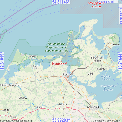
Klausdorf GPS coordinates[2]
54° 24' 15.264" North, 13° 0' 47.916" East
| Map corner | latitude | longitude |
|---|---|---|
| Upper-left | 54.81146°, | 12.31019° |
| Center: | 54.40424°, | 13.01331° |
| Lower-right: | 53.99293°, | 13.71644° |
| Map W x H: | 91×91 km | = 56.5×56.5mi |
| max Lat: | 55.01917° ⇑2.5% North |
| Klausdorf: | 54.40424° |
| min Lat: | ⇓97.5% South 47.40724° |
| min Long | Klausdorf | max Long |
| 5.92978° | 13.01331° | 14.98853° |
| W 92.4%⇐ | ⇒7.6% E |
Elevation
Elevation of Klausdorf is 9 m = 30 ft, and this is 240.1 m = 788 ft below average elevation for this country.
| Max E: |
1256 m = 4121 ft | 94.8% |
| Avg. | 249.1 m = 817 ft | |
| Klausdorf | 9 m = 30 ft | |
Min E: |
-5 m = -16 ft | 5.2% |
See also: Germany elevation on elevation.city.
Geographical zone
Klausdorf is located in North temperate zone (between Tropic of Cancer and the Arctic Circle). Distance of this North polar circle is 1352 km =840.1 mi to North.| Distance of | km | miles | from Klausdorf |
|---|---|---|---|
| North Pole | 3957.9 | 2459.3 | to North |
| Arctic Circle | 1352 | 840.1 | to North |
| Tropic Cancer | 3443.3 | 2139.6 | to South |
| Equator | 6049.2 | 3758.8 | to South |


Nearby cities:
15 places around Klausdorf: (largest is in red/bold)
• Altefähr
11 km =6.8 mi,  138°
138°
• Altenpleen
6.6 km =4.1 mi,  213°
213°
• Gingst
16.8 km =10.4 mi,  69°
69°
• Groß Mohrdorf
4.6 km =2.9 mi,  246°
246°
• Kramerhof
6.2 km =3.9 mi,  154°
154°
• Lüssow
13.7 km =8.5 mi,  175°
175°
• Niepars
11.5 km =7.1 mi, 209°
• Pantelitz
11.8 km =7.3 mi,  194°
194°
• Preetz
6.2 km =3.9 mi, 194°
• Prohn
4 km =2.5 mi,  170°
170°
• Rambin
13.5 km =8.4 mi,  113°
113°
• Schaprode
15.7 km =9.8 mi,  39°
39°
• Stralsund
11.5 km =7.1 mi,  157°
157°
• Ummanz
13.6 km =8.5 mi, 71°
• Wendorf
17.1 km =10.6 mi, 166°
Sources, notices
• [Note1] Compared only with cities in Germany existing in our database
• [Src1] Map data: © OpenStreetMap contributors (CC-BY-SA)
• [Src2] Other city data from geonames.org with taken over terms of usage.
• [Src3] Geographical zone / Annual Mean Temperature by Robert A. Rohde @ Wikipedia
