Kasseburg geodata
Kasseburg (Schleswig-Holstein) is a seat of a fourth-order administrative division; located in Germany in Europe/Berlin (GMT+2) time zone. With population of 554 people, there are 9060 cities with bigger population in this country. Compared to other cities in Germany, 86.5% of cities are located further ↓South; 57.3% of cities are located further ←West and 82% of cities have higher elevation than Kasseburg. Note1
Administrative division(s):
- Level 1: Schleswig-Holstein
- Level 3: Kreis Herzogtum Lauenburg
- Level 4: Kasseburg


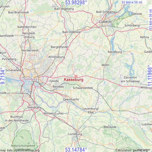
Kasseburg GPS coordinates[2]
53° 34' 2.892" North, 10° 24' 59.508" East
| Map corner | latitude | longitude |
|---|---|---|
| Upper-left | 53.98298°, | 9.7134° |
| Center: | 53.56747°, | 10.41653° |
| Lower-right: | 53.14784°, | 11.11966° |
| Map W x H: | 92.9×92.9 km | = 57.7×57.7mi |
| max Lat: | 55.01917° ⇑13.5% North |
| Kasseburg: | 53.56747° |
| min Lat: | ⇓86.5% South 47.40724° |
| min Long | Kasseburg | max Long |
| 5.92978° | 10.41653° | 14.98853° |
| W 57.3%⇐ | ⇒42.7% E |
Elevation
Elevation of Kasseburg is 42 m = 138 ft, and this is 207.1 m = 679 ft below average elevation for this country.
| Max E: |
1256 m = 4121 ft | 82% |
| Avg. | 249.1 m = 817 ft | |
| Kasseburg | 42 m = 138 ft | |
Min E: |
-5 m = -16 ft | 18% |
See also: Germany elevation on elevation.city.
Geographical zone
Kasseburg is located in North temperate zone (between Tropic of Cancer and the Arctic Circle). Distance of this North polar circle is 1445 km =897.9 mi to North.| Distance of | km | miles | from Kasseburg |
|---|---|---|---|
| North Pole | 4050.9 | 2517.1 | to North |
| Arctic Circle | 1445 | 897.9 | to North |
| Tropic Cancer | 3350.2 | 2081.7 | to South |
| Equator | 5956.1 | 3700.9 | to South |


Nearby cities:
15 places around Kasseburg: (largest is in red/bold)
• Basthorst
3.9 km =2.4 mi,  74°
74°
• Dahmker
2.8 km =1.7 mi,  51°
51°
• Elmenhorst
8.2 km =5.1 mi,  107°
107°
• Fuhlenhagen
7.4 km =4.6 mi,  85°
85°
• Grande
2.8 km =1.7 mi,  308°
308°
• Grove
5.8 km =3.6 mi,  130°
130°
• Großensee
7.1 km =4.4 mi, 314°
• Havekost
3.8 km =2.4 mi,  120°
120°
• Hohenfelde
8 km =5 mi,  24°
24°
• Kuddewörde
2.1 km =1.3 mi,  328°
328°
• Möhnsen
2.2 km =1.4 mi, 92°
• Mühlenrade
5.7 km =3.5 mi,  55°
55°
• Rausdorf
6.2 km =3.9 mi,  293°
293°
• Trittau
5.6 km =3.5 mi,  348°
348°
• Witzhave
5.5 km =3.4 mi,  269°
269°
Sources, notices
• [Note1] Compared only with cities in Germany existing in our database
• [Src1] Map data: © OpenStreetMap contributors (CC-BY-SA)
• [Src2] Other city data from geonames.org with taken over terms of usage.
• [Src3] Geographical zone / Annual Mean Temperature by Robert A. Rohde @ Wikipedia
