Havekost geodata
Havekost (Schleswig-Holstein) is a seat of a fourth-order administrative division; located in Germany in Europe/Berlin (GMT+2) time zone. With population of 135 people, there are 10739 cities with bigger population in this country. Compared to other cities in Germany, 86.2% of cities are located further ↓South; 58.3% of cities are located further ←West and 82% of cities have higher elevation than Havekost. Note1
Administrative division(s):
- Level 1: Schleswig-Holstein
- Level 3: Kreis Herzogtum Lauenburg
- Level 4: Havekost


Havekost GPS coordinates[2]
53° 33' 0" North, 10° 28' 0.012" East
| Map corner | latitude | longitude |
|---|---|---|
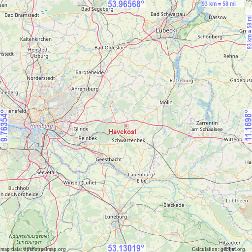
| Upper-left | 53.96568°, | 9.76354° |
| Center: | 53.55°, | 10.46667° |
| Lower-right: | 53.13019°, | 11.1698° |
| Map W x H: | 92.9×92.9 km | = 57.7×57.7mi |
| max Lat: | 55.01917° ⇑13.8% North |
| Havekost: | 53.55° |
| min Lat: | ⇓86.2% South 47.40724° |
| min Long | Havekost | max Long |
| 5.92978° | 10.46667° | 14.98853° |
| W 58.3%⇐ | ⇒41.7% E |
Elevation
Elevation of Havekost is 42 m = 138 ft, and this is 207.1 m = 679 ft below average elevation for this country.
| Max E: |
1256 m = 4121 ft | 82% |
| Avg. | 249.1 m = 817 ft | |
| Havekost | 42 m = 138 ft | |
Min E: |
-5 m = -16 ft | 18% |
See also: Germany elevation on elevation.city.
Geographical zone
Havekost is located in North temperate zone (between Tropic of Cancer and the Arctic Circle). Distance of this North polar circle is 1447 km =899.1 mi to North.| Distance of | km | miles | from Havekost |
|---|---|---|---|
| North Pole | 4052.9 | 2518.4 | to North |
| Arctic Circle | 1447 | 899.1 | to North |
| Tropic Cancer | 3348.3 | 2080.5 | to South |
| Equator | 5954.2 | 3699.8 | to South |


Nearby cities:
15 places around Havekost: (largest is in red/bold)
• Basthorst
3 km =1.9 mi,  8°
8°
• Brunstorf
6.9 km =4.3 mi,  203°
203°
• Dahmker
3.9 km =2.4 mi,  343°
343°
• Elmenhorst
4.6 km =2.9 mi,  96°
96°
• Fuhlenhagen
4.8 km =3 mi,  57°
57°
• Grabau
5.4 km =3.4 mi,  138°
138°
• Grande
6.6 km =4.1 mi,  303°
303°
• Grove
2.2 km =1.4 mi,  149°
149°
• Kankelau
6.6 km =4.1 mi,  90°
90°
• Kasseburg
3.8 km =2.4 mi, 300°
• Kuddewörde
5.8 km =3.6 mi,  310°
310°
• Möhnsen
2.2 km =1.4 mi,  329°
329°
• Mühlenrade
5.3 km =3.3 mi,  15°
15°
• Sahms
5.2 km =3.2 mi,  121°
121°
• Schwarzenbek
5.3 km =3.3 mi,  170°
170°
Sources, notices
• [Note1] Compared only with cities in Germany existing in our database
• [Src1] Map data: © OpenStreetMap contributors (CC-BY-SA)
• [Src2] Other city data from geonames.org with taken over terms of usage.
• [Src3] Geographical zone / Annual Mean Temperature by Robert A. Rohde @ Wikipedia
