Illerich geodata
Illerich (Rheinland-Pfalz) is a seat of a fourth-order administrative division; located in Germany in Europe/Berlin (GMT+2) time zone. With population of 758 people, there are 8055 cities with bigger population in this country. Compared to other cities in Germany, 59% of cities are located further ↑North; 91.6% of cities are located further →East and 73.9% of cities have lower elevation than Illerich. Note1
Administrative division(s):
- Level 1: Rheinland-Pfalz
- Level 3: Landkreis Cochem-Zell
- Level 4: Illerich


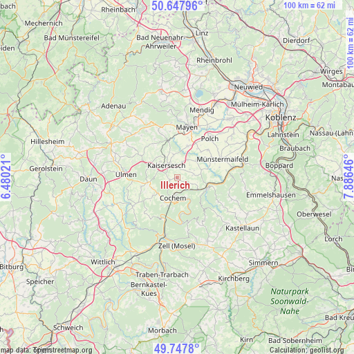
Illerich GPS coordinates[2]
50° 12' 0" North, 7° 10' 59.988" East
| Map corner | latitude | longitude |
|---|---|---|
| Upper-left | 50.64796°, | 6.48021° |
| Center: | 50.2°, | 7.18333° |
| Lower-right: | 49.7478°, | 7.88646° |
| Map W x H: | 100.1×100.1 km | = 62.2×62.2mi |
| max Lat: | 55.01917° ⇑59% North |
| Illerich: | 50.2° |
| min Lat: | ⇓41% South 47.40724° |
| min Long | Illerich | max Long |
| 5.92978° | 7.18333° | 14.98853° |
| W 8.4%⇐ | ⇒91.6% E |
Elevation
Elevation of Illerich is 389 m = 1276 ft, and this is 139.9 m = 459 ft above average elevation for this country.
| Max E: |
1256 m = 4121 ft | 26.1% |
| Illerich | 389 m 1276 ft | |
| Avg. | 249.1 m = 817 ft | |
Min E: |
-5 m = -16 ft | 73.9% |
See also: Germany elevation on elevation.city.
Geographical zone
Illerich is located in North temperate zone (between Tropic of Cancer and the Arctic Circle). Distance of this North polar circle is 1819.5 km =1130.6 mi to North.| Distance of | km | miles | from Illerich |
|---|---|---|---|
| North Pole | 4425.3 | 2749.8 | to North |
| Arctic Circle | 1819.5 | 1130.6 | to North |
| Tropic Cancer | 2975.8 | 1849.1 | to South |
| Equator | 5581.7 | 3468.3 | to South |


Nearby cities:
15 places around Illerich: (largest is in red/bold)
• Binningen
4.5 km =2.8 mi,  80°
80°
• Brachtendorf
5.1 km =3.2 mi,  43°
43°
• Dünfus
4 km =2.5 mi,  62°
62°
• Eulgem
3.9 km =2.4 mi,  342°
342°
• Gamlen
3.9 km =2.4 mi,  17°
17°
• Greimersburg
4 km =2.5 mi,  242°
242°
• Hambuch
2.8 km =1.7 mi,  358°
358°
• Kaifenheim
5.9 km =3.7 mi,  31°
31°
• Kail
4 km =2.5 mi,  117°
117°
• Kaisersesch
4.7 km =2.9 mi,  317°
317°
• Klotten
3.9 km =2.4 mi,  162°
162°
• Landkern
2.2 km =1.4 mi,  252°
252°
• Valwig
6 km =3.7 mi, 156°
• Wirfus
1.2 km =0.7 mi,  90°
90°
• Zettingen
3.9 km =2.4 mi, 17°
Sources, notices
• [Note1] Compared only with cities in Germany existing in our database
• [Src1] Map data: © OpenStreetMap contributors (CC-BY-SA)
• [Src2] Other city data from geonames.org with taken over terms of usage.
• [Src3] Geographical zone / Annual Mean Temperature by Robert A. Rohde @ Wikipedia
