Hambuch geodata
Hambuch (Rheinland-Pfalz) is a seat of a fourth-order administrative division; located in Germany in Europe/Berlin (GMT+2) time zone. With population of 683 people, there are 8401 cities with bigger population in this country. Compared to other cities in Germany, 58.5% of cities are located further ↑North; 91.6% of cities are located further →East and 74.3% of cities have lower elevation than Hambuch. Note1
Administrative division(s):
- Level 1: Rheinland-Pfalz
- Level 3: Landkreis Cochem-Zell
- Level 4: Hambuch


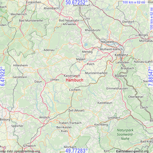
Hambuch GPS coordinates[2]
50° 13' 29.28" North, 7° 10' 56.424" East
| Map corner | latitude | longitude |
|---|---|---|
| Upper-left | 50.67252°, | 6.47922° |
| Center: | 50.2248°, | 7.18234° |
| Lower-right: | 49.77283°, | 7.88547° |
| Map W x H: | 100×100 km | = 62.1×62.1mi |
| max Lat: | 55.01917° ⇑58.5% North |
| Hambuch: | 50.2248° |
| min Lat: | ⇓41.5% South 47.40724° |
| min Long | Hambuch | max Long |
| 5.92978° | 7.18234° | 14.98853° |
| W 8.4%⇐ | ⇒91.6% E |
Elevation
Elevation of Hambuch is 392 m = 1286 ft, and this is 142.9 m = 469 ft above average elevation for this country.
| Max E: |
1256 m = 4121 ft | 25.7% |
| Hambuch | 392 m 1286 ft | |
| Avg. | 249.1 m = 817 ft | |
Min E: |
-5 m = -16 ft | 74.3% |
See also: Germany elevation on elevation.city.
Geographical zone
Hambuch is located in North temperate zone (between Tropic of Cancer and the Arctic Circle). Distance of this North polar circle is 1816.7 km =1128.8 mi to North.| Distance of | km | miles | from Hambuch |
|---|---|---|---|
| North Pole | 4422.6 | 2748.1 | to North |
| Arctic Circle | 1816.7 | 1128.8 | to North |
| Tropic Cancer | 2978.6 | 1850.8 | to South |
| Equator | 5584.5 | 3470 | to South |


Nearby cities:
15 places around Hambuch: (largest is in red/bold)
• Binningen
5 km =3.1 mi,  114°
114°
• Brachtendorf
3.7 km =2.3 mi,  75°
75°
• Dünfus
3.7 km =2.3 mi,  103°
103°
• Düngenheim
4.2 km =2.6 mi,  343°
343°
• Eulgem
1.5 km =0.9 mi,  310°
310°
• Gamlen
1.6 km =1 mi,  52°
52°
• Illerich
2.8 km =1.7 mi,  178°
178°
• Kaifenheim
3.9 km =2.4 mi, 54°
• Kaisersesch
3.2 km =2 mi,  283°
283°
• Landkern
4 km =2.5 mi,  210°
210°
• Masburg
4.9 km =3 mi,  290°
290°
• Roes
5.8 km =3.6 mi,  69°
69°
• Urmersbach
4.5 km =2.8 mi, 308°
• Wirfus
3 km =1.9 mi,  155°
155°
• Zettingen
1.6 km =1 mi, 52°
Sources, notices
• [Note1] Compared only with cities in Germany existing in our database
• [Src1] Map data: © OpenStreetMap contributors (CC-BY-SA)
• [Src2] Other city data from geonames.org with taken over terms of usage.
• [Src3] Geographical zone / Annual Mean Temperature by Robert A. Rohde @ Wikipedia
