Hoogstede geodata
Hoogstede (Lower Saxony) is a seat of a fourth-order administrative division; located in Germany in Europe/Berlin (GMT+2) time zone. With population of 2,793 people, there are 4166 cities with bigger population in this country. Compared to other cities in Germany, 78.5% of cities are located further ↓South; 94% of cities are located further →East and 92.7% of cities have higher elevation than Hoogstede. Note1
Administrative division(s):
- Level 1: Lower Saxony
- Level 3: Landkreis Grafschaft Bentheim
- Level 4: Hoogstede


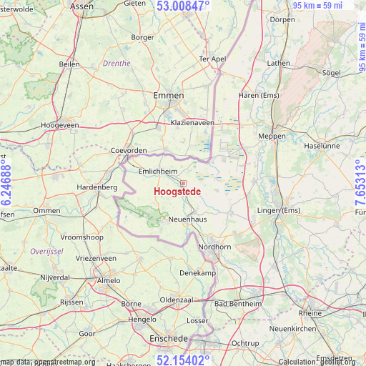
Hoogstede GPS coordinates[2]
52° 34' 59.988" North, 6° 57' 0" East
| Map corner | latitude | longitude |
|---|---|---|
| Upper-left | 53.00847°, | 6.24688° |
| Center: | 52.58333°, | 6.95° |
| Lower-right: | 52.15402°, | 7.65313° |
| Map W x H: | 95×95 km | = 59×59mi |
| max Lat: | 55.01917° ⇑21.5% North |
| Hoogstede: | 52.58333° |
| min Lat: | ⇓78.5% South 47.40724° |
| min Long | Hoogstede | max Long |
| 5.92978° | 6.95° | 14.98853° |
| W 6%⇐ | ⇒94% E |
Elevation
Elevation of Hoogstede is 14 m = 46 ft, and this is 235.1 m = 771 ft below average elevation for this country.
| Max E: |
1256 m = 4121 ft | 92.7% |
| Avg. | 249.1 m = 817 ft | |
| Hoogstede | 14 m = 46 ft | |
Min E: |
-5 m = -16 ft | 7.3% |
See also: Germany elevation on elevation.city.
Geographical zone
Hoogstede is located in North temperate zone (between Tropic of Cancer and the Arctic Circle). Distance of this North polar circle is 1554.5 km =965.9 mi to North.| Distance of | km | miles | from Hoogstede |
|---|---|---|---|
| North Pole | 4160.3 | 2585.1 | to North |
| Arctic Circle | 1554.5 | 965.9 | to North |
| Tropic Cancer | 3240.8 | 2013.7 | to South |
| Equator | 5846.7 | 3633 | to South |


Nearby cities:
15 places around Hoogstede: (largest is in red/bold)
• Emlichheim
7.7 km =4.8 mi,  298°
298°
• Esche
5.7 km =3.5 mi,  168°
168°
• Geeste
21.5 km =13.4 mi,  85°
85°
• Georgsdorf
9.2 km =5.7 mi,  101°
101°
• Getelo
14.6 km =9.1 mi,  207°
207°
• Gölenkamp
7.7 km =4.8 mi,  196°
196°
• Itterbeck
13.1 km =8.1 mi,  229°
229°
• Laar
15.1 km =9.4 mi,  284°
284°
• Lohne
21 km =13 mi,  116°
116°
• Nordhorn
18.8 km =11.7 mi,  154°
154°
• Twist
9.9 km =6.2 mi,  52°
52°
• Uelsen
10.3 km =6.4 mi, 205°
• Wielen
16.2 km =10.1 mi,  256°
256°
• Wietmarschen
14.4 km =8.9 mi, 120°
• Wilsum
8.8 km =5.5 mi, 230°
Sources, notices
• [Note1] Compared only with cities in Germany existing in our database
• [Src1] Map data: © OpenStreetMap contributors (CC-BY-SA)
• [Src2] Other city data from geonames.org with taken over terms of usage.
• [Src3] Geographical zone / Annual Mean Temperature by Robert A. Rohde @ Wikipedia
