Hohenschwangau geodata
Hohenschwangau (Bavaria) is a populated place; located in Germany in Europe/Berlin (GMT+2) time zone. With population of 1,000 people, there are 7180 cities with bigger population in this country. Compared to other cities in Germany, 99.8% of cities are located further ↑North; 63.2% of cities are located further ←West and 99.3% of cities have lower elevation than Hohenschwangau. Note1
Administrative division(s):
- Level 1: Bavaria
- Level 2: Swabia
- Level 3: Landkreis Ostallgäu
- Level 4: Schwangau


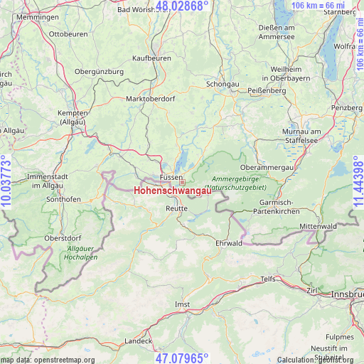
Hohenschwangau GPS coordinates[2]
47° 33' 22.716" North, 10° 44' 27.06" East
| Map corner | latitude | longitude |
|---|---|---|
| Upper-left | 48.02868°, | 10.03773° |
| Center: | 47.55631°, | 10.74085° |
| Lower-right: | 47.07965°, | 11.44398° |
| Map W x H: | 105.5×105.5 km | = 65.6×65.6mi |
| max Lat: | 55.01917° ⇑99.8% North |
| Hohenschwangau: | 47.55631° |
| min Lat: | ⇓0.2% South 47.40724° |
| min Long | Hohenschwangau | max Long |
| 5.92978° | 10.74085° | 14.98853° |
| W 63.2%⇐ | ⇒36.8% E |
Elevation
Elevation of Hohenschwangau is 807 m = 2648 ft, and this is 557.9 m = 1830 ft above average elevation for this country.
| Max E: |
1256 m = 4121 ft | 0.7% |
| Hohenschwangau | 807 m 2648 ft | |
| Avg. | 249.1 m = 817 ft | |
Min E: |
-5 m = -16 ft | 99.3% |
See also: Germany elevation on elevation.city.
Geographical zone
Hohenschwangau is located in North temperate zone (between Tropic of Cancer and the Arctic Circle). Distance of this North polar circle is 2113.4 km =1313.2 mi to North.| Distance of | km | miles | from Hohenschwangau |
|---|---|---|---|
| North Pole | 4719.3 | 2932.4 | to North |
| Arctic Circle | 2113.4 | 1313.2 | to North |
| Tropic Cancer | 2681.8 | 1666.4 | to South |
| Equator | 5287.8 | 3285.7 | to South |


Nearby cities:
15 places around Hohenschwangau: (largest is in red/bold)
• Bernbeuren
20.3 km =12.6 mi,  7°
7°
• Eisenberg
11.9 km =7.4 mi,  302°
302°
• Füssen
3.4 km =2.1 mi, 299°
• Halblech
10.3 km =6.4 mi,  35°
35°
• Hopferau
10.5 km =6.5 mi,  309°
309°
• Lechbruck
16.7 km =10.4 mi, 14°
• Lengenwang
19.1 km =11.9 mi,  326°
326°
• Nesselwang
19.4 km =12.1 mi,  292°
292°
• Pfronten
14.6 km =9.1 mi,  281°
281°
• Prem
14.8 km =9.2 mi,  17°
17°
• Roßhaupten
10.6 km =6.6 mi,  350°
350°
• Rückholz
18.8 km =11.7 mi, 310°
• Schwangau
2.4 km =1.5 mi, 347°
• Seeg
14.8 km =9.2 mi, 314°
• Steingaden
18.6 km =11.6 mi,  30°
30°
Sources, notices
• [Note1] Compared only with cities in Germany existing in our database
• [Src1] Map data: © OpenStreetMap contributors (CC-BY-SA)
• [Src2] Other city data from geonames.org with taken over terms of usage.
• [Src3] Geographical zone / Annual Mean Temperature by Robert A. Rohde @ Wikipedia
