Hohendorf geodata
Hohendorf (Mecklenburg-Vorpommern) is a populated place; located in Germany in Europe/Berlin (GMT+2) time zone. With population of 954 people, there are 7333 cities with bigger population in this country. Compared to other cities in Germany, 93% of cities are located further ↓South; 96.9% of cities are located further ←West and 97% of cities have higher elevation than Hohendorf. Note1
Administrative division(s):
- Level 1: Mecklenburg-Vorpommern
- Level 3: Vorpommern-Greifswald
- Level 4: Wolgast


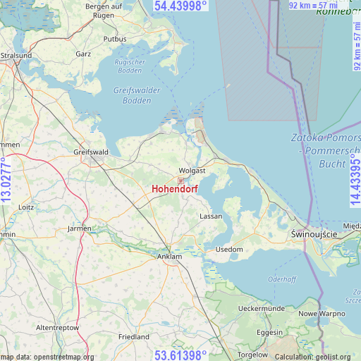
Hohendorf GPS coordinates[2]
54° 1' 44.508" North, 13° 43' 50.952" East
| Map corner | latitude | longitude |
|---|---|---|
| Upper-left | 54.43998°, | 13.0277° |
| Center: | 54.02903°, | 13.73082° |
| Lower-right: | 53.61398°, | 14.43395° |
| Map W x H: | 91.8×91.8 km | = 57×57mi |
| max Lat: | 55.01917° ⇑7% North |
| Hohendorf: | 54.02903° |
| min Lat: | ⇓93% South 47.40724° |
| min Long | Hohendorf | max Long |
| 5.92978° | 13.73082° | 14.98853° |
| W 96.9%⇐ | ⇒3.1% E |
Elevation
Elevation of Hohendorf is 4 m = 13 ft, and this is 245.1 m = 804 ft below average elevation for this country.
| Max E: |
1256 m = 4121 ft | 97% |
| Avg. | 249.1 m = 817 ft | |
| Hohendorf | 4 m = 13 ft | |
Min E: |
-5 m = -16 ft | 3% |
See also: Germany elevation on elevation.city.
Geographical zone
Hohendorf is located in North temperate zone (between Tropic of Cancer and the Arctic Circle). Distance of this North polar circle is 1393.7 km =866 mi to North.| Distance of | km | miles | from Hohendorf |
|---|---|---|---|
| North Pole | 3999.6 | 2485.2 | to North |
| Arctic Circle | 1393.7 | 866 | to North |
| Tropic Cancer | 3401.5 | 2113.6 | to South |
| Equator | 6007.5 | 3732.9 | to South |


Nearby cities:
15 places around Hohendorf: (largest is in red/bold)
• Hanshagen
12.4 km =7.7 mi,  278°
278°
• Karlshagen
11.3 km =7 mi,  35°
35°
• Katzow
4 km =2.5 mi,  299°
299°
• Klein Bünzow
12.7 km =7.9 mi,  210°
210°
• Kröslin
9.8 km =6.1 mi,  7°
7°
• Lassan
11.9 km =7.4 mi,  138°
138°
• Lühmannsdorf
6.6 km =4.1 mi,  250°
250°
• Mölschow
8.5 km =5.3 mi,  51°
51°
• Neu Boltenhagen
8.9 km =5.5 mi, 297°
• Ostseebad Zinnowitz
12.9 km =8 mi,  65°
65°
• Rubkow
10.5 km =6.5 mi,  182°
182°
• Trassenheide
10.7 km =6.6 mi, 54°
• Wolgast
3.8 km =2.4 mi, 45°
• Wusterhusen
12 km =7.5 mi,  321°
321°
• Zemitz
5.9 km =3.7 mi,  164°
164°
Sources, notices
• [Note1] Compared only with cities in Germany existing in our database
• [Src1] Map data: © OpenStreetMap contributors (CC-BY-SA)
• [Src2] Other city data from geonames.org with taken over terms of usage.
• [Src3] Geographical zone / Annual Mean Temperature by Robert A. Rohde @ Wikipedia
