Mastershausen geodata
Mastershausen (Rheinland-Pfalz) is a seat of a fourth-order administrative division; located in Germany in Europe/Berlin (GMT+2) time zone. With population of 1,202 people, there are 6555 cities with bigger population in this country. Compared to other cities in Germany, 62.2% of cities are located further ↑North; 89.3% of cities are located further →East and 77.2% of cities have lower elevation than Mastershausen. Note1
Administrative division(s):
- Level 1: Rheinland-Pfalz
- Level 3: Rhein-Hunsrück-Kreis
- Level 4: Mastershausen


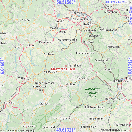
Mastershausen GPS coordinates[2]
50° 4' 0.012" North, 7° 21' 0" East
| Map corner | latitude | longitude |
|---|---|---|
| Upper-left | 50.51588°, | 6.64687° |
| Center: | 50.06667°, | 7.35° |
| Lower-right: | 49.61321°, | 8.05312° |
| Map W x H: | 100.4×100.4 km | = 62.4×62.4mi |
| max Lat: | 55.01917° ⇑62.2% North |
| Mastershausen: | 50.06667° |
| min Lat: | ⇓37.8% South 47.40724° |
| min Long | Mastershausen | max Long |
| 5.92978° | 7.35° | 14.98853° |
| W 10.7%⇐ | ⇒89.3% E |
Elevation
Elevation of Mastershausen is 413 m = 1355 ft, and this is 163.9 m = 538 ft above average elevation for this country.
| Max E: |
1256 m = 4121 ft | 22.8% |
| Mastershausen | 413 m 1355 ft | |
| Avg. | 249.1 m = 817 ft | |
Min E: |
-5 m = -16 ft | 77.2% |
See also: Germany elevation on elevation.city.
Geographical zone
Mastershausen is located in North temperate zone (between Tropic of Cancer and the Arctic Circle). Distance of this North polar circle is 1834.3 km =1139.8 mi to North.| Distance of | km | miles | from Mastershausen |
|---|---|---|---|
| North Pole | 4440.2 | 2759 | to North |
| Arctic Circle | 1834.3 | 1139.8 | to North |
| Tropic Cancer | 2961 | 1839.9 | to South |
| Equator | 5566.9 | 3459.1 | to South |


Nearby cities:
15 places around Mastershausen: (largest is in red/bold)
• Altstrimmig
5.1 km =3.2 mi,  316°
316°
• Bell
4.7 km =2.9 mi,  97°
97°
• Blankenrath
4.6 km =2.9 mi,  227°
227°
• Buch
3 km =1.9 mi,  69°
69°
• Haserich
3.9 km =2.4 mi,  197°
197°
• Hesweiler
5.1 km =3.2 mi,  248°
248°
• Korweiler
6 km =3.7 mi,  52°
52°
• Liesenich
5.1 km =3.2 mi,  291°
291°
• Mittelstrimmig
5.1 km =3.2 mi, 291°
• Mörsdorf
3.7 km =2.3 mi,  0°
0°
• Reidenhausen
3 km =1.9 mi, 232°
• Sosberg
2.2 km =1.4 mi,  327°
327°
• Uhler
6.2 km =3.9 mi, 72°
• Walhausen
6 km =3.7 mi, 232°
• Zilshausen
6 km =3.7 mi,  23°
23°
Sources, notices
• [Note1] Compared only with cities in Germany existing in our database
• [Src1] Map data: © OpenStreetMap contributors (CC-BY-SA)
• [Src2] Other city data from geonames.org with taken over terms of usage.
• [Src3] Geographical zone / Annual Mean Temperature by Robert A. Rohde @ Wikipedia
