Heidekamp geodata
Heidekamp (Schleswig-Holstein) is a seat of a fourth-order administrative division; located in Germany in Europe/Berlin (GMT+2) time zone. With population of 489 people, there are 9418 cities with bigger population in this country. Compared to other cities in Germany, 90.6% of cities are located further ↓South; 58.9% of cities are located further ←West and 93.1% of cities have higher elevation than Heidekamp. Note1


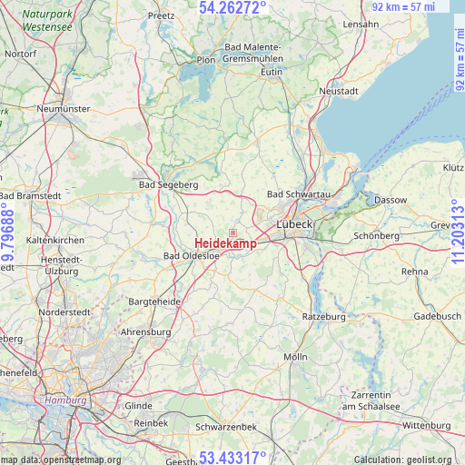
Heidekamp GPS coordinates[2]
53° 51' 0" North, 10° 30' 0" East
| Map corner | latitude | longitude |
|---|---|---|
| Upper-left | 54.26272°, | 9.79688° |
| Center: | 53.85°, | 10.5° |
| Lower-right: | 53.43317°, | 11.20313° |
| Map W x H: | 92.2×92.2 km | = 57.3×57.3mi |
| max Lat: | 55.01917° ⇑9.4% North |
| Heidekamp: | 53.85° |
| min Lat: | ⇓90.6% South 47.40724° |
| min Long | Heidekamp | max Long |
| 5.92978° | 10.5° | 14.98853° |
| W 58.9%⇐ | ⇒41.1% E |
Elevation
Elevation of Heidekamp is 13 m = 43 ft, and this is 236.1 m = 775 ft below average elevation for this country.
| Max E: |
1256 m = 4121 ft | 93.1% |
| Avg. | 249.1 m = 817 ft | |
| Heidekamp | 13 m = 43 ft | |
Min E: |
-5 m = -16 ft | 6.9% |
See also: Germany elevation on elevation.city.
Geographical zone
Heidekamp is located in North temperate zone (between Tropic of Cancer and the Arctic Circle). Distance of this North polar circle is 1413.6 km =878.4 mi to North.| Distance of | km | miles | from Heidekamp |
|---|---|---|---|
| North Pole | 4019.5 | 2497.6 | to North |
| Arctic Circle | 1413.6 | 878.4 | to North |
| Tropic Cancer | 3381.6 | 2101.2 | to South |
| Equator | 5987.6 | 3720.5 | to South |


Nearby cities:
15 places around Heidekamp: (largest is in red/bold)
• Badendorf
4.7 km =2.9 mi,  67°
67°
• Barnitz
5.6 km =3.5 mi,  180°
180°
• Grinau
8.1 km =5 mi,  156°
156°
• Groß Schenkenberg
7.1 km =4.4 mi,  141°
141°
• Hamberge
5.8 km =3.6 mi,  108°
108°
• Heilshoop
4.3 km =2.7 mi,  30°
30°
• Klein Wesenberg
4.9 km =3 mi, 138°
• Meddewade
6 km =3.7 mi,  221°
221°
• Mönkhagen
6.5 km =4 mi, 30°
• Rehhorst
4.3 km =2.7 mi,  329°
329°
• Reinfeld
2.1 km =1.3 mi,  195°
195°
• Steinfeld
5.1 km =3.2 mi,  248°
248°
• Strukdorf
7.5 km =4.7 mi,  351°
351°
• Wesenberg
3.8 km =2.4 mi,  119°
119°
• Zarpen
2.2 km =1.4 mi, 30°
Sources, notices
• [Note1] Compared only with cities in Germany existing in our database
• [Src1] Map data: © OpenStreetMap contributors (CC-BY-SA)
• [Src2] Other city data from geonames.org with taken over terms of usage.
• [Src3] Geographical zone / Annual Mean Temperature by Robert A. Rohde @ Wikipedia
