Halbemond geodata
Halbemond (Lower Saxony) is a seat of a fourth-order administrative division; located in Germany in Europe/Berlin (GMT+2) time zone. With population of 1,041 people, there are 7046 cities with bigger population in this country. Compared to other cities in Germany, 86.4% of cities are located further ↓South; 90.1% of cities are located further →East and 98.6% of cities have higher elevation than Halbemond. Note1


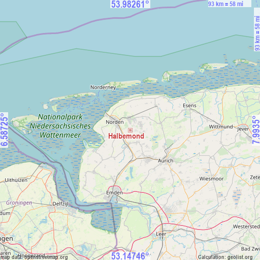
Halbemond GPS coordinates[2]
53° 34' 1.56" North, 7° 17' 25.368" East
| Map corner | latitude | longitude |
|---|---|---|
| Upper-left | 53.98261°, | 6.58725° |
| Center: | 53.5671°, | 7.29038° |
| Lower-right: | 53.14746°, | 7.9935° |
| Map W x H: | 92.9×92.9 km | = 57.7×57.7mi |
| max Lat: | 55.01917° ⇑13.6% North |
| Halbemond: | 53.5671° |
| min Lat: | ⇓86.4% South 47.40724° |
| min Long | Halbemond | max Long |
| 5.92978° | 7.29038° | 14.98853° |
| W 9.9%⇐ | ⇒90.1% E |
Elevation
Elevation of Halbemond is 1 m = 3 ft, and this is 248.1 m = 814 ft below average elevation for this country.
| Max E: |
1256 m = 4121 ft | 98.6% |
| Avg. | 249.1 m = 817 ft | |
| Halbemond | 1 m = 3 ft | |
Min E: |
-5 m = -16 ft | 1.4% |
See also: Germany elevation on elevation.city.
Geographical zone
Halbemond is located in North temperate zone (between Tropic of Cancer and the Arctic Circle). Distance of this North polar circle is 1445.1 km =897.9 mi to North.| Distance of | km | miles | from Halbemond |
|---|---|---|---|
| North Pole | 4051 | 2517.2 | to North |
| Arctic Circle | 1445.1 | 897.9 | to North |
| Tropic Cancer | 3350.2 | 2081.7 | to South |
| Equator | 5956.1 | 3700.9 | to South |


Nearby cities:
15 places around Halbemond: (largest is in red/bold)
• Berumbur
4 km =2.5 mi,  25°
25°
• Eversmeer
9.5 km =5.9 mi,  94°
94°
• Hage
4 km =2.5 mi,  355°
355°
• Hagermarsch
9.2 km =5.7 mi,  3°
3°
• Leezdorf
2 km =1.2 mi,  161°
161°
• Lütetsburg
4.5 km =2.8 mi,  323°
323°
• Marienhafe
5.1 km =3.2 mi,  193°
193°
• Nenndorf
9.6 km =6 mi,  79°
79°
• Norddeich
10 km =6.2 mi,  301°
301°
• Norden
6.4 km =4 mi, 299°
• Osteel
3.5 km =2.2 mi,  223°
223°
• Rechtsupweg
4.7 km =2.9 mi,  142°
142°
• Upgant-Schott
5.6 km =3.5 mi,  184°
184°
• Westerholt
11.2 km =7 mi,  70°
70°
• Wirdum
11.5 km =7.1 mi,  209°
209°
Sources, notices
• [Note1] Compared only with cities in Germany existing in our database
• [Src1] Map data: © OpenStreetMap contributors (CC-BY-SA)
• [Src2] Other city data from geonames.org with taken over terms of usage.
• [Src3] Geographical zone / Annual Mean Temperature by Robert A. Rohde @ Wikipedia
