Norden geodata
Norden (Lower Saxony) is a populated place; located in Germany in Europe/Berlin (GMT+2) time zone. With population of 25,093 people, there are 585 cities with bigger population in this country. Compared to other cities in Germany, 86.9% of cities are located further ↓South; 91.3% of cities are located further →East and 95.2% of cities have higher elevation than Norden. Note1


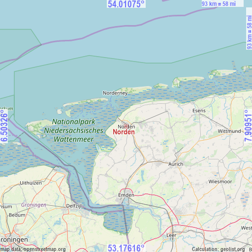
Norden GPS coordinates[2]
53° 35' 43.872" North, 7° 12' 23.004" East
| Map corner | latitude | longitude |
|---|---|---|
| Upper-left | 54.01075°, | 6.50326° |
| Center: | 53.59552°, | 7.20639° |
| Lower-right: | 53.17616°, | 7.90951° |
| Map W x H: | 92.8×92.8 km | = 57.7×57.7mi |
| max Lat: | 55.01917° ⇑13.1% North |
| Norden: | 53.59552° |
| min Lat: | ⇓86.9% South 47.40724° |
| min Long | Norden | max Long |
| 5.92978° | 7.20639° | 14.98853° |
| W 8.7%⇐ | ⇒91.3% E |
Elevation
Elevation of Norden is 8 m = 26 ft, and this is 241.1 m = 791 ft below average elevation for this country.
| Max E: |
1256 m = 4121 ft | 95.2% |
| Avg. | 249.1 m = 817 ft | |
| Norden | 8 m = 26 ft | |
Min E: |
-5 m = -16 ft | 4.8% |
See also: Germany elevation on elevation.city.
Geographical zone
Norden is located in North temperate zone (between Tropic of Cancer and the Arctic Circle). Distance of this North polar circle is 1441.9 km =896 mi to North.| Distance of | km | miles | from Norden |
|---|---|---|---|
| North Pole | 4047.8 | 2515.2 | to North |
| Arctic Circle | 1441.9 | 896 | to North |
| Tropic Cancer | 3353.3 | 2083.6 | to South |
| Equator | 5959.3 | 3702.9 | to South |


Nearby cities:
15 places around Norden: (largest is in red/bold)
• Berumbur
7.3 km =4.5 mi,  86°
86°
• Eversmeer
15.5 km =9.6 mi,  104°
104°
• Hage
5.3 km =3.3 mi,  81°
81°
• Hagermarsch
8.6 km =5.3 mi,  45°
45°
• Halbemond
6.4 km =4 mi,  119°
119°
• Leezdorf
8 km =5 mi,  129°
129°
• Lütetsburg
2.9 km =1.8 mi, 80°
• Marienhafe
9.2 km =5.7 mi,  151°
151°
• Nenndorf
15 km =9.3 mi, 95°
• Norddeich
3.6 km =2.2 mi,  303°
303°
• Norderney
12.9 km =8 mi,  345°
345°
• Osteel
6.5 km =4 mi, 151°
• Rechtsupweg
10.9 km =6.8 mi, 129°
• Upgant-Schott
10.1 km =6.3 mi, 149°
• Wirdum
13.2 km =8.2 mi,  180°
180°
Sources, notices
• [Note1] Compared only with cities in Germany existing in our database
• [Src1] Map data: © OpenStreetMap contributors (CC-BY-SA)
• [Src2] Other city data from geonames.org with taken over terms of usage.
• [Src3] Geographical zone / Annual Mean Temperature by Robert A. Rohde @ Wikipedia
