Gorsleben geodata
Gorsleben (Thuringia) is a seat of a fourth-order administrative division; located in Germany in Europe/Berlin (GMT+2) time zone. With population of 622 people, there are 8710 cities with bigger population in this country. Compared to other cities in Germany, 62.8% of cities are located further ↓South; 69.7% of cities are located further ←West and 63% of cities have higher elevation than Gorsleben. Note1
Administrative division(s):
- Level 1: Thuringia
- Level 3: Kyffhäuserkreis
- Level 4: Stadt An der Schmücke


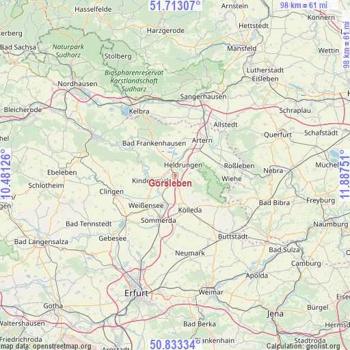
Gorsleben GPS coordinates[2]
51° 16' 31.116" North, 11° 11' 3.768" East
| Map corner | latitude | longitude |
|---|---|---|
| Upper-left | 51.71307°, | 10.48126° |
| Center: | 51.27531°, | 11.18438° |
| Lower-right: | 50.83334°, | 11.88751° |
| Map W x H: | 97.8×97.8 km | = 60.8×60.8mi |
| max Lat: | 55.01917° ⇑37.2% North |
| Gorsleben: | 51.27531° |
| min Lat: | ⇓62.8% South 47.40724° |
| min Long | Gorsleben | max Long |
| 5.92978° | 11.18438° | 14.98853° |
| W 69.7%⇐ | ⇒30.3% E |
Elevation
Elevation of Gorsleben is 132 m = 433 ft, and this is 117.1 m = 384 ft below average elevation for this country.
| Max E: |
1256 m = 4121 ft | 63% |
| Avg. | 249.1 m = 817 ft | |
| Gorsleben | 132 m = 433 ft | |
Min E: |
-5 m = -16 ft | 37% |
See also: Germany elevation on elevation.city.
Geographical zone
Gorsleben is located in North temperate zone (between Tropic of Cancer and the Arctic Circle). Distance of this North polar circle is 1699.9 km =1056.3 mi to North.| Distance of | km | miles | from Gorsleben |
|---|---|---|---|
| North Pole | 4305.8 | 2675.5 | to North |
| Arctic Circle | 1699.9 | 1056.3 | to North |
| Tropic Cancer | 3095.4 | 1923.4 | to South |
| Equator | 5701.3 | 3542.6 | to South |


Nearby cities:
15 places around Gorsleben: (largest is in red/bold)
• Beichlingen
7 km =4.3 mi,  132°
132°
• Bretleben
7.3 km =4.5 mi,  27°
27°
• Büchel
3.7 km =2.3 mi,  220°
220°
• Esperstedt
8 km =5 mi,  357°
357°
• Etzleben
1.6 km =1 mi,  232°
232°
• Griefstedt
6.4 km =4 mi, 216°
• Hauteroda
7 km =4.3 mi,  97°
97°
• Heldrungen
3.8 km =2.4 mi,  38°
38°
• Hemleben
3.6 km =2.2 mi,  141°
141°
• Kannawurf
3.7 km =2.3 mi,  254°
254°
• Kindelbrück
6.7 km =4.2 mi,  257°
257°
• Oberheldrungen
4.7 km =2.9 mi,  78°
78°
• Oldisleben
3.9 km =2.4 mi,  346°
346°
• Riethgen
5.5 km =3.4 mi,  239°
239°
• Schillingstedt
4.8 km =3 mi,  166°
166°
Sources, notices
• [Note1] Compared only with cities in Germany existing in our database
• [Src1] Map data: © OpenStreetMap contributors (CC-BY-SA)
• [Src2] Other city data from geonames.org with taken over terms of usage.
• [Src3] Geographical zone / Annual Mean Temperature by Robert A. Rohde @ Wikipedia
