Hauteroda geodata
Hauteroda (Thuringia) is a seat of a fourth-order administrative division; located in Germany in Europe/Berlin (GMT+2) time zone. With population of 617 people, there are 8732 cities with bigger population in this country. Compared to other cities in Germany, 62.7% of cities are located further ↓South; 71% of cities are located further ←West and 51.3% of cities have higher elevation than Hauteroda. Note1
Administrative division(s):
- Level 1: Thuringia
- Level 3: Kyffhäuserkreis
- Level 4: Stadt An der Schmücke


Hauteroda GPS coordinates[2]
51° 16' 0.012" North, 11° 16' 59.988" East
| Map corner | latitude | longitude |
|---|---|---|
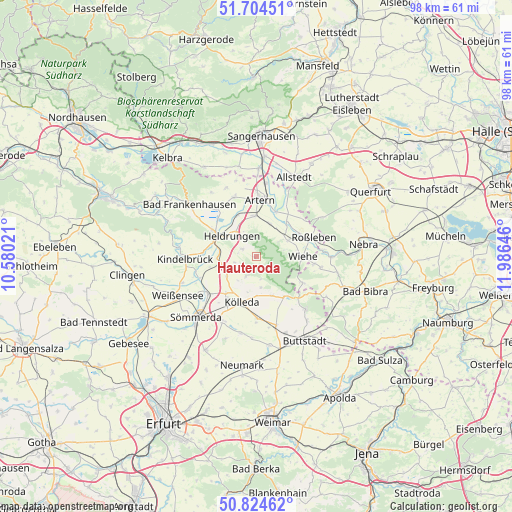
| Upper-left | 51.70451°, | 10.58021° |
| Center: | 51.26667°, | 11.28333° |
| Lower-right: | 50.82462°, | 11.98646° |
| Map W x H: | 97.8×97.8 km | = 60.8×60.8mi |
| max Lat: | 55.01917° ⇑37.3% North |
| Hauteroda: | 51.26667° |
| min Lat: | ⇓62.7% South 47.40724° |
| min Long | Hauteroda | max Long |
| 5.92978° | 11.28333° | 14.98853° |
| W 71%⇐ | ⇒29% E |
Elevation
Elevation of Hauteroda is 216 m = 709 ft, and this is 33.1 m = 109 ft below average elevation for this country.
| Max E: |
1256 m = 4121 ft | 51.3% |
| Avg. | 249.1 m = 817 ft | |
| Hauteroda | 216 m = 709 ft | |
Min E: |
-5 m = -16 ft | 48.7% |
See also: Germany elevation on elevation.city.
Geographical zone
Hauteroda is located in North temperate zone (between Tropic of Cancer and the Arctic Circle). Distance of this North polar circle is 1700.9 km =1056.9 mi to North.| Distance of | km | miles | from Hauteroda |
|---|---|---|---|
| North Pole | 4306.7 | 2676.1 | to North |
| Arctic Circle | 1700.9 | 1056.9 | to North |
| Tropic Cancer | 3094.4 | 1922.8 | to South |
| Equator | 5700.3 | 3542 | to South |


Nearby cities:
15 places around Hauteroda: (largest is in red/bold)
• Beichlingen
4.2 km =2.6 mi,  205°
205°
• Bretleben
8.2 km =5.1 mi,  334°
334°
• Donndorf
6.9 km =4.3 mi,  63°
63°
• Etzleben
8.1 km =5 mi,  270°
270°
• Gehofen
6.7 km =4.2 mi,  22°
22°
• Gorsleben
7 km =4.3 mi,  277°
277°
• Großmonra
6 km =3.7 mi,  171°
171°
• Heldrungen
6 km =3.7 mi,  310°
310°
• Hemleben
5 km =3.1 mi,  248°
248°
• Nausitz
6.6 km =4.1 mi,  32°
32°
• Oberheldrungen
3 km =1.9 mi, 308°
• Ostramondra
8.2 km =5.1 mi,  154°
154°
• Reinsdorf
7.5 km =4.7 mi,  351°
351°
• Schillingstedt
6.9 km =4.3 mi,  237°
237°
• Schönewerda
8.6 km =5.3 mi,  42°
42°
Sources, notices
• [Note1] Compared only with cities in Germany existing in our database
• [Src1] Map data: © OpenStreetMap contributors (CC-BY-SA)
• [Src2] Other city data from geonames.org with taken over terms of usage.
• [Src3] Geographical zone / Annual Mean Temperature by Robert A. Rohde @ Wikipedia
