Girkenroth geodata
Girkenroth (Rheinland-Pfalz) is a seat of a fourth-order administrative division; located in Germany in Europe/Berlin (GMT+2) time zone. With population of 637 people, there are 8614 cities with bigger population in this country. Compared to other cities in Germany, 52.3% of cities are located further ↑North; 77.6% of cities are located further →East and 75.5% of cities have lower elevation than Girkenroth. Note1


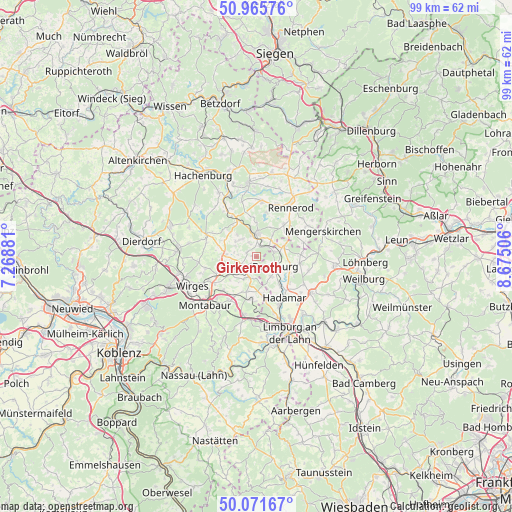
Girkenroth GPS coordinates[2]
50° 31' 14.988" North, 7° 58' 18.984" East
| Map corner | latitude | longitude |
|---|---|---|
| Upper-left | 50.96576°, | 7.26881° |
| Center: | 50.52083°, | 7.97194° |
| Lower-right: | 50.07167°, | 8.67506° |
| Map W x H: | 99.4×99.4 km | = 61.8×61.8mi |
| max Lat: | 55.01917° ⇑52.3% North |
| Girkenroth: | 50.52083° |
| min Lat: | ⇓47.7% South 47.40724° |
| min Long | Girkenroth | max Long |
| 5.92978° | 7.97194° | 14.98853° |
| W 22.4%⇐ | ⇒77.6% E |
Elevation
Elevation of Girkenroth is 401 m = 1316 ft, and this is 151.9 m = 498 ft above average elevation for this country.
| Max E: |
1256 m = 4121 ft | 24.5% |
| Girkenroth | 401 m 1316 ft | |
| Avg. | 249.1 m = 817 ft | |
Min E: |
-5 m = -16 ft | 75.5% |
See also: Germany elevation on elevation.city.
Geographical zone
Girkenroth is located in North temperate zone (between Tropic of Cancer and the Arctic Circle). Distance of this North polar circle is 1783.8 km =1108.4 mi to North.| Distance of | km | miles | from Girkenroth |
|---|---|---|---|
| North Pole | 4389.7 | 2727.6 | to North |
| Arctic Circle | 1783.8 | 1108.4 | to North |
| Tropic Cancer | 3011.5 | 1871.3 | to South |
| Equator | 5617.4 | 3490.5 | to South |


Nearby cities:
15 places around Girkenroth: (largest is in red/bold)
• Berod bei Wallmerod
5 km =3.1 mi,  213°
213°
• Berzhahn
3.3 km =2.1 mi,  49°
49°
• Bilkheim
3 km =1.9 mi, 213°
• Brandscheid
5.8 km =3.6 mi,  320°
320°
• Gemünden
5.3 km =3.3 mi,  36°
36°
• Guckheim
2.1 km =1.3 mi,  311°
311°
• Härtlingen
3.9 km =2.4 mi,  275°
275°
• Kaden
5 km =3.1 mi, 306°
• Kölbingen
4.2 km =2.6 mi, 319°
• Molsberg
4.2 km =2.6 mi,  169°
169°
• Salz
1.3 km =0.8 mi, 206°
• Wallmerod
4.4 km =2.7 mi,  200°
200°
• Weltersburg
1.5 km =0.9 mi,  327°
327°
• Westerburg
4.3 km =2.7 mi,  2°
2°
• Willmenrod
2.4 km =1.5 mi,  16°
16°
Sources, notices
• [Note1] Compared only with cities in Germany existing in our database
• [Src1] Map data: © OpenStreetMap contributors (CC-BY-SA)
• [Src2] Other city data from geonames.org with taken over terms of usage.
• [Src3] Geographical zone / Annual Mean Temperature by Robert A. Rohde @ Wikipedia
